Final thoughts on Antarctic history and this field season
One of the major themes of this field season was Antarctic history- no doubt generated by the many anniversaries that fell on this Austral summer, but also from the remarkable monuments we visited during our surveys. This feeling was reinforced by a talk we attended on our last night in McMurdo given by some members of the Antarctic Heritage Trust about their work on the Terra Nova Hut at Cape Evans. This effort was much larger than I had imagined- not only was an entire team in place at the Hut all summer doing restoration, but part of Scott Base has been dedicated to a group of conservators who work on the more delicate artifacts in a lab, in fact a winter-over team has arrived who will continue the effort all winter. And the results of the restoration were stunning, the hut has now been excavated out from tons of drifting snow that buried it over the past 100 years, and wind-directing devices have been installed that will hopefully prevent it from being buried again. Massive amounts of repair and restoration has taken place on the hut’s structure, all using authentic materials (much of which is still available in Britain), and delicate fixtures have been carefully dried and repaired. The hut now looks exactly like it looked in Ponting’s photos from the expedition, including the weather vane in place on the roof! And artifacts have been skillfully repaired and conserved- the most impressive to me was the restoration of the rusty remains of a skinny-tired bicycle that I noticed when I visited the Hut in previous years. It turns out that the bike belonged to Griffith Taylor (who led the scientific party to Cape Geology), and he rode it on an excursion from Cape Evans to the Erebus Ice Tongue to the south (halfway to Hut Point) in 1911. During the lecture, photos that the conservators showed of their work depicted a beautiful, almost workable racing bike. To learn more about the conservation work going on in the Ross Sea, check out their blog.
Click on the images below for a larger version.
 |
 |
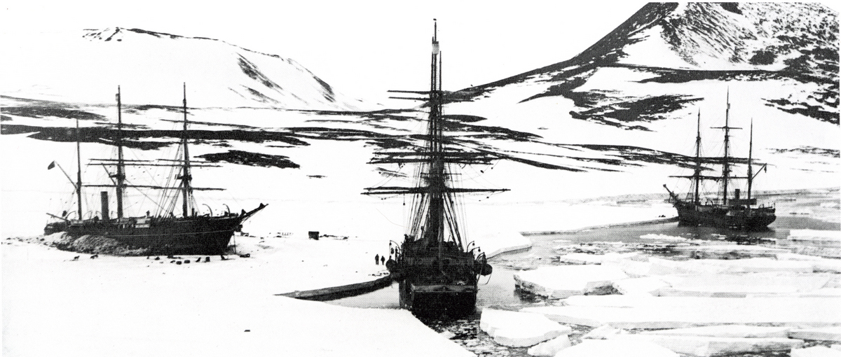
100 years of Antarctic history- Winter Quarters Bay in 1904, with Discovery frozen in the ice, and relief ships Terra Nova and Morning in open water: Herbert Ponting photo (top). The same scene in 2012, with loose brash ice (from the icebreaker) in the Bay, and McMurdo filling the volcanic flats between Observatory Hill and Arrival Heights (bottom).
The presentation concluded with a lecture and slide show by Falcon Scott about the experience of working on his grandfather’s hut with his own two hands. He began by justifying his invitation to join the conservation efforts by showing some images of the incredible homes he built and historic buildings he restored in Great Britain. His stories and photos depicting the series of multi-storied towers he built as a young teenager on his parent’s property adjacent to a nature reserve were impressive, and the stonework and custom woodwork he does today must be near the pinnacle of the craft. He then recapped the highlights of his famous grandfather’s exploits, and summarized the account of the final journey to the Pole and its fatal conclusion on the Ross Ice Shelf. He showed a bit of his contribution to the restoration efforts, beginning with the latrines, and concluding with some detailed exterior work on the hut. Finally, he told us a bit about his family today, and showed photos of some of the anniversary events he attended that have been going on all over Europe, New Zealand, and in Antarctica in remembrance of the events 100 years ago. One off-hand comment he made that struck me was that the Scotts, Amundsens, and Nansens are all great friends now- far removed from the great rivalries that existed at the turn of the century. A final note from the conservators’ talk that generated some excitement in our group- the next project they will tackle will be the repair and restoration of Borchgrevink’s Hut on Ridley Beach at Cape Adare. We have been trying to arrange the logistics for an extended stay at Adare for the past decade, but have been unsuccessful because of the extreme remoteness of the site, and the fickle weather that arises quickly there. But with an extended restoration effort underway (lasting three seasons) which will require substantial logistical support, it should be possible to dovetail a small field party conducting scientific research with the larger project. Steve spoke briefly to the conservators after the talk, and they agreed, so now it’s up to obtaining the funding for extending our project- not an easy task considering today’s tight resources.
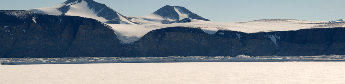
Back home now, I am immersed in much of the original literature written by the historical figures themselves about the historic monuments we visited during this field season, and the amazing stories surrounding their construction and use. I can now see the attraction of historical archaeology- unlike our work in Range Creek Canyon, where from their artifacts and features we have only the dimmest understanding of who the Fremont were, and how they carried on their daily lives, with Antarctic historical documentation I can read about the people, personalities, their actions, and events surrounding what they left behind. In some cases I can even refer to multiple accounts of the same event, providing insight into omissions or biases of particular reporters. And there is a rich photographic record from the era, allowing the matching up of photos from the Heroic Era to photos I took only a few weeks ago. Concerning the historic cairn we visited on Depot Island, I have learned that it was constructed by Professor Edgeworth David’s party on their way to the South Magnetic Pole in October of 1908, one of the off-shoots of Shackleton’s Nimrod expedition. David was a geologist from Australia who was originally planning to return with the Nimrod after the expedition was positioned at Cape Royds, but he was apparently so well-liked that Shackleton asked him to stay over, and he agreed. Shortly after their arrival he led the sledging party that summitted Mt. Erebus, collecting geologic samples and data, and viewing the active inner crater for the first time. And the following Fall he was tasked with leading the geologic party up the coastline as far north as the Drygalski Ice Tongue, and then climbing up onto the polar plateau to locate the Magnetic Pole. Their slow pace on the way up the coast demanded that they cache samples and many supplies so they could complete their exploration and get back to the coast in time for Nimrod to find them and pick them up during the Austral summer. The prominence of Depot Island suggested it as an obvious depot site, and they constructed the large cairn we visited on the summit (built by surgeon Dr. A. F. Mackay), erected the sturdy bamboo in the center, and attached a black flag to it for visibility. I now regret not looking more closely at the metal tin at the site, as they also created a postbox where letters were left in case they were not heard from again- and it’s possible the tin we saw was the mailbox. After an intense effort which succeeded in reaching the Magnetic Pole (where the inclination needle pointed straight down) on January of 1909, they were collected by the Nimrod and made it safely back to Cape Royds, although their depot was unreachable by sea. It wasn’t until October of 1912, when the Northern Party sent out by Scott’s Terra Nova expedition (Campbell, Priestley, et al. after their miserable winter-over on Inexpressible Island) found the depot that the letters and samples were collected and brought back to Cape Evans (and learned that Scott’s polar party had not returned). The history of Cape Geology and Granite House was equally rich, detailed in Griffith Taylor’s memoir With Scott: The Silver Lining (1916). The descriptions and photos of the region clearly describe what we saw, with one important detail that we missed- insects! The Western Party documented Antarctic springtails in pools of water on the Cape, and I never thought to look for them as I thought they were only found on the Peninsula. But since they are only about a millimeter long it was an easy miss; perhaps Jurek’s samples will include a few.
 |
|
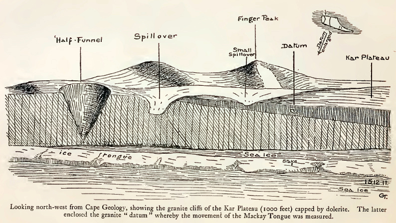
Sketch map of the Kar Plateau across from Cape Geology by Griffith Taylor (1916), showing the datums he established to measure movement of the ice tongue as one foot per day, and photographic panorama from the same spot in 2012.
 |
 |
 |
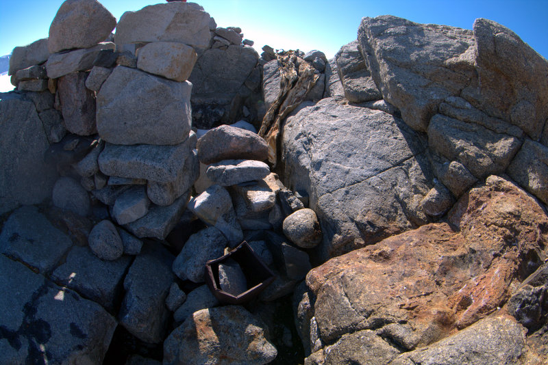 |
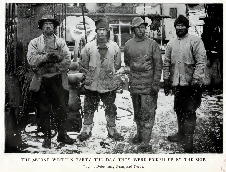
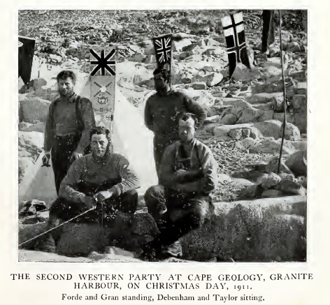
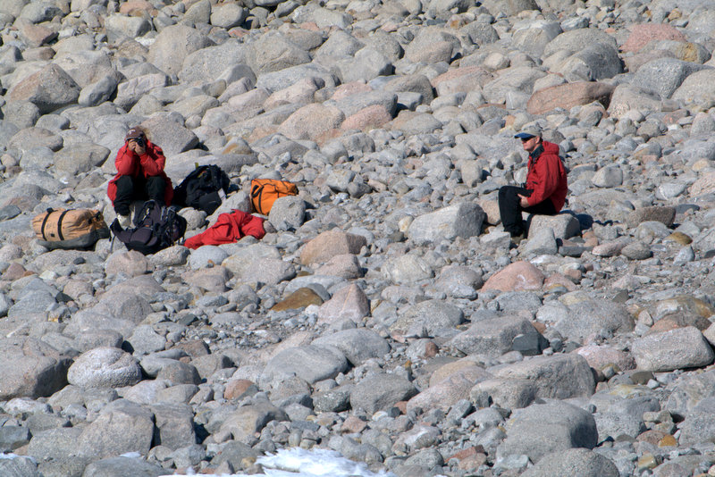
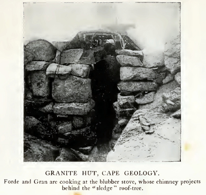
Photo of the Western Party at Cape Geology in 1911, and Tao and Steve in roughly the same spot this field season. The Granite House at Cape Geology as it appeared in 1911-1912, and how it appears today. (Historic photos from With Scott: The Silver Lining by Griffith Taylor, 1916)
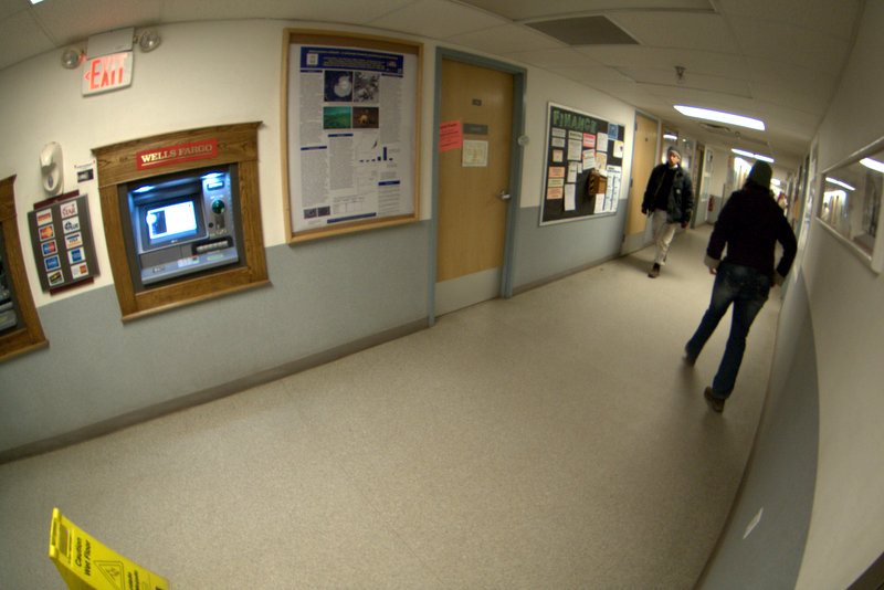
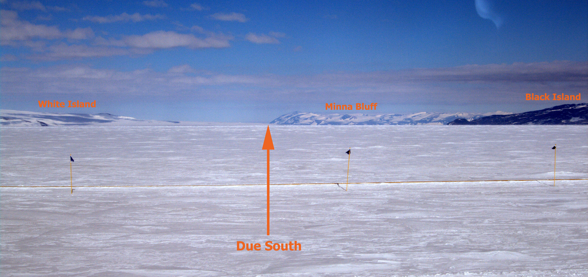
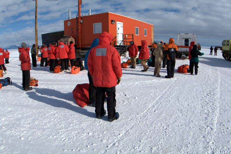
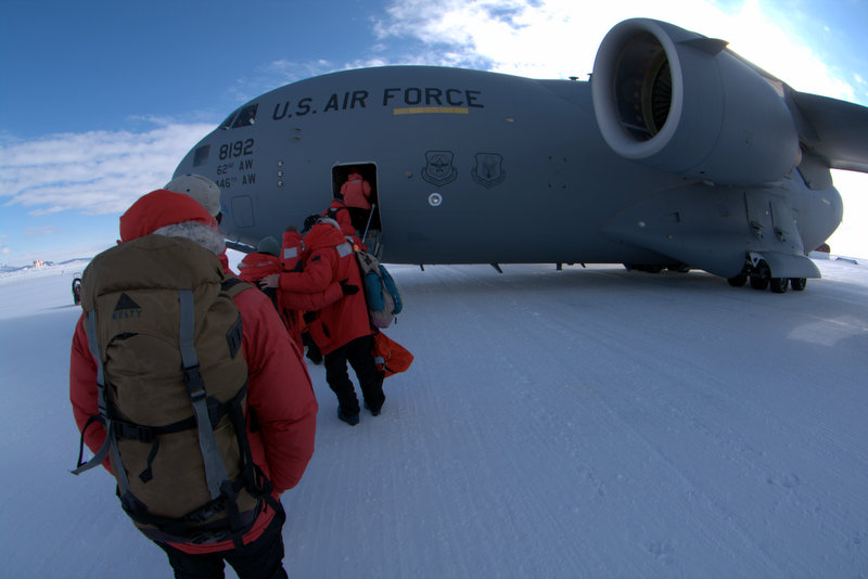
As we got ready to depart the continent this season, I was surprised to find myself a bit nostalgic about McMurdo, even though I frequently protest that it’s my least favorite place on Earth (or “not Antarctica” as Steve puts it). Since this is likely to be the last time I’ll be down here (if a grant for Adare comes through it will probably be supported by ship), I strolled around and took some photos of notable places in “town” that I’ve spent time over these five field seasons. As I mentioned before, the Crary Science Lab is our office away from office, and the most hours of any given trip are spent within its comfortable spaces. The other building whose insides you get to know well is Building 155- where the galley is located, and traversed by the hallway designated Highway One (mysteriously not shown as a street on Google Maps), along which all matters McMurdo are on display. The final stages of leaving the continent include “bag drag”, where you carry (drag) ALL your gear to the Post Office to be weighed for flight, then carry your personal gear back to your room, and then monitoring the TV scroll for news on transport time to Pegasus for your flight. The typical departure on Ivan the Terror Bus begins hours before the plane arrives, which requires a long wait on the ice runway before boarding. On the drive out this year, with history so much on my mind, I noted when we were in position to be directly on the line the polar parties would have used on their journeys south- referenced by the centerline between White and Black Islands, detouring around the tip of Minna Bluff. But perhaps this year operations have gotten more efficient, as we were only at Pegasus for a little over an hour before cargo was loaded into the C-17 and we were permitted to board. The flight to Christchurch was uneventful; since cloud cover was wall-to-wall I didn’t request a trip to the flight deck as I usually do. But a couple of hours off New Zealand a number of folks who had been working at McMurdo or Pole all season became excited about something they could see out the small porthole on the aircraft. Finally I got a chance to see for myself, and the clouds had not broken, but what they were excited about was seeing a sunset- the first they’d seen in months. On arrival we cleared customs, gathered our bags to clear agricultural inspection, then headed for the CDC to return our clothing. Finally a shuttle ride dropped us off at the YMCA around 1:30 AM, having left McMurdo at 2:30 PM. I planned to return immediately to Salt Lake, so my next day began again at 5:00 AM, and from then until 3:50 PM on Sunday I was either on a plane, or in an airport, for a total of 45 hours of travel since we boarded Ivan at McMurdo (broken only by the 4 hours or so at the Y).
 |
 |
 |
 |
 |
 |
 |
 |
 |
 |
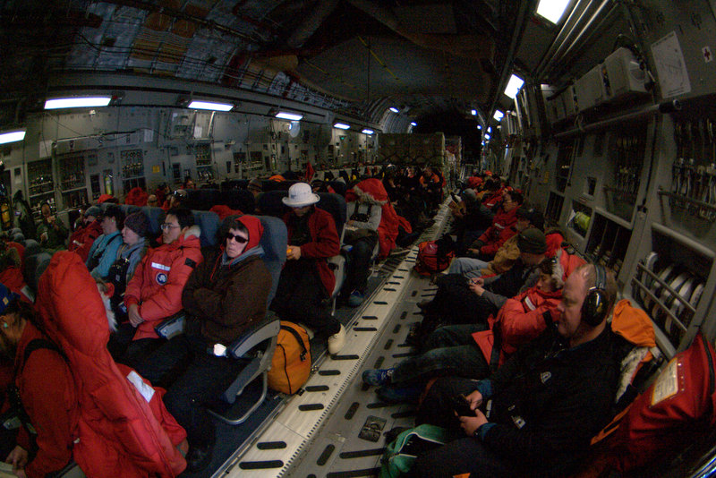
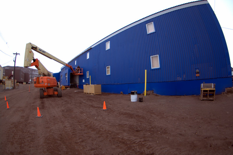
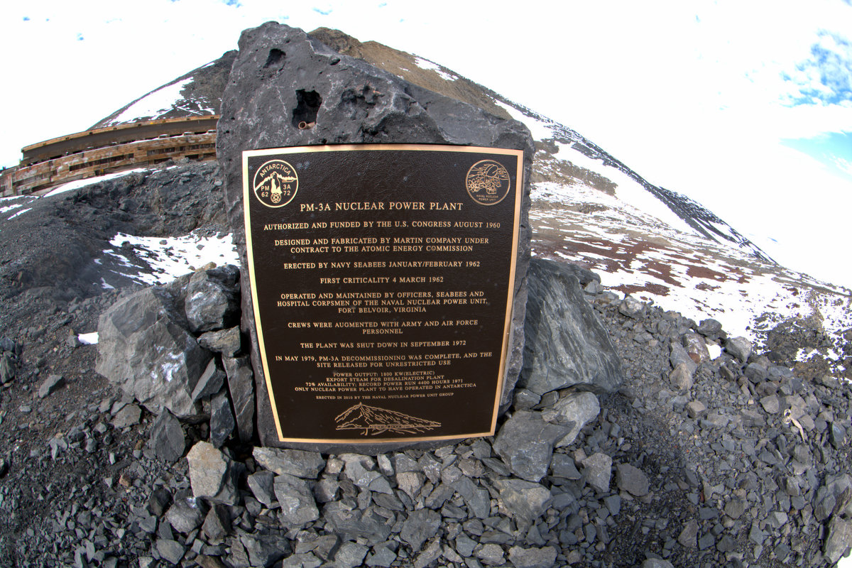
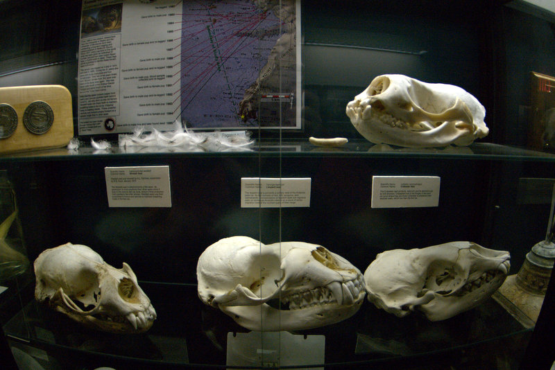
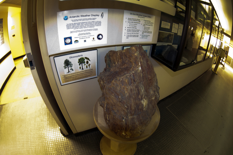
McMurdo scenes: Building 155, Highway One, McMurdo weekly activities, and the site of the nuclear power plant on the side of Ob Hill (Navy-era). Two displays in Crary Lab: prepared seal skulls, and an impressive Glossopteris fossil tree trunk. Scenes from departing Antarctica: the view south from the drive to Pegasus on Ivan the Terror Bus (this is the view that the Terra Nova party carefully scanned daily for signs of the lost polar crew), the wait at Pegasus for the aircraft, boarding the C-17, the impressive Starlifter engines with a crew member for scale, and the crowded interior of the C-17 during the flight back to Christchurch.
Video: the C-17 Starlifter arrives at Pegasus Airfield
To summarize my thoughts on our scientific efforts this season- despite numerous weather problems which affected helo operations, we eventually succeeded in reaching all the destinations we had planned. And I can now say with some confidence that we have exhaustively surveyed the southern Victoria Land (Scott) Coast for fossil penguin sites, from Black Island and Cape Chocolate in the south, to the Drygalski Ice Tongue in the north, we have walked on every bit of exposed land that is likely to contain sites. And we were just as exhaustive when we worked out of Mario Zucchelli Station on Terra Nova Bay- from there south to the Drygalski we were just as thorough. Only the northernmost Ross Sea coastline has been partially surveyed because of its remoteness and difficulty of access- gaps surely exist between Cape Adare, Cape Hallett, and Edmondson Point, so if future work were planned, it would be these gaps that need to be filled. Concerning the locations of sites, there were some surprises this season- we did not expect to find high sites at Cape Ross, on Depot Island, or on Tripp Island, but in fact we did. There is some chance that the ages of these sites may change our interpretation of occupation history in the Ross Sea, but at this point we don’t anticipate them to fall outside the brackets of the “Penguin Optimum” between 2 and 4 thousand years ago. And I suspect that the stable isotope studies that Steve will conduct on bone and eggshell recovered this season will likely show the same patterns as we’ve seen before- with birds feeding higher on the food web for the past 1000’s of years, and only shifting to krill in the past 150 years (due to krill being more available after whale populations were decimated). DNA studies are only in their infancy, so it’s hard to say what may be revealed beyond some insight into the evolutionary rate (see Lambert et al. 2002 for example). Perhaps with more data we can flesh out the occupation history with more details on which colonies moved where as environmental conditions changed, but that analysis will have to wait for much more work on the DNA of modern birds.
One other important scientific question that arises concerns the future of Adélie penguins in the much warmer world that will arrive (is arriving?) soon in the Ross Sea region. What our work clearly demonstrates is how adaptable this penguin species can be concerning environmental conditions- when open water is available earlier in the season along the southern Scott Coast I expect Adélies will move in right away, and we will witness occupations analogous to those of the penguin optimum. And there is a lot more south to move to in the Ross Sea- especially if the Ross Ice Shelf retreats, hundreds of kilometers of coastline would become available for maternity colonies, allowing significant populations to abandon the north (where sea ice would be less frequent) and move south (where sea ice should be sufficient to sustain large krill and fish populations). But some recent work on the Antarctic Peninsula may presage a more complicated path for the survival of Adélie penguins. Trivelpiece et al. (2011) have demonstrated a decline in the numbers of both “ice-loving” and “ice-avoiding” species of penguins in the Scotia Sea, an unexpected result: strictly environmentally-speaking as the sea ice declines, Adélie numbers would be expected to fall, and populations of chinstrap penguins would be expected to climb, but this is not what’s happening. Instead, Trivelpiece et al. (2011) argue that coincident with the environmental changes affecting the penguins are fishing impacts, and the beginning of the recovery of sea mammal (whales, seals) populations that can now outcompete the penguins for krill. And unlike prehistoric conditions, the penguins have no unexploited food source to shift to- fisheries are now extracting tons of fish and squid that are their alternative food choice. So, in fact, the fate of Adélie penguins are as much in question as that of emperor penguins in the Anthropocene- only time will tell how well their evolved adaptive strategies will serve them in a new world.
Lambert, D. M., P. A. Ritchie, C. D. Millar, B. Holland, A. J. Drummond, C. Baroni (2002). Rates of Evolution in Ancient DNA from Adélie Penguins. Science 295, 2270-2273.
Wayne Z. Trivelpiece, Jefferson T. Hinke, Aileen K. Miller, Christian S. Reiss, Susan G. Trivelpiece, and George M. Watters (2011). Variability in krill biomass links harvesting and climate warming to penguin population changes in Antarctica. Proceedings of the National Academy of Sciences 108, 7625-7628.
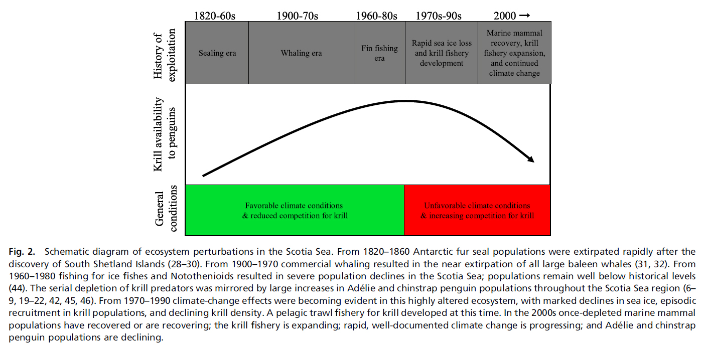
Fig. 2 from Trivelpiece et al. (2011)- graphically depicting a model of ecosystem change over the past few hundred years in the Scotia Sea.
Finally, I have been pondering how much the practice of data collection in Antarctica has changed over the past 100 years. This season we casually flew to sites more than 160 km away from McMurdo to spend only 7 or 8 hours on the ground, then flew back in time for dinner in the galley. What is clear from reading the Historic-era accounts is that science was very much in the forefront of their efforts as well, but the logistics demanded sledging for days (weeks!) across sea ice and glaciers, encountering all manner of difficulties and complications, just to reach the sites we reached in a hour or two of flying. They used approach by sea whenever feasible, but it seldom was due to most of the coastline being clogged by sea ice most of the year. But rather than lament their difficulties, their accounts sound as though it was all taken in stride, even when those difficulties included an unplanned winter-over in a spot as grim as Inexpressible Island. Their efforts are to be greatly admired, and their hard work provided the basis for all the refined research that has followed. It was an honor this season to walk in their footsteps while we conducted our own, very humble version of scientific research.