Update #5: Cape Chocolate
After a couple of days in McMurdo, processing sediments and getting caught up on emails and business we scheduled a day trip across the sound to Cape Chocolate. We heard a rumor that abandoned sites had been discovered there during some geologic investigations, and although this area is quite a bit south of anywhere we’ve found sites before, we knew we needed to go take a look. The map shows quite a lot of exposed shoreline both to the north and south of the cape, so we knew we’d have plenty to look at. The weather here in McMurdo was brisk, with sub-freezing temperatures, as stiff wind, and a lowering cloud base, so I was a little apprehensive about conditions along the coast. We got a call from Helo Ops to let us know we could earlier than planned, because so many missions were being canceled because of the weather. We grabbed our gear and headed down to the helo pad.
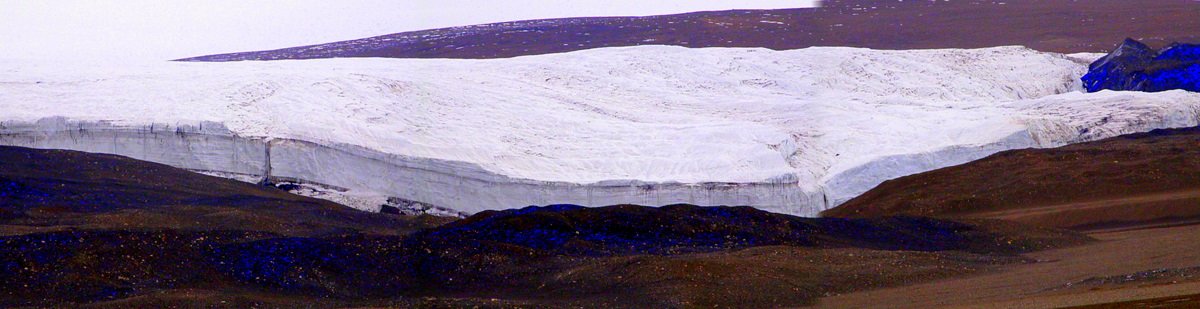
The flight across the southern sound is interesting for its glacial geomorphology- half way across moraines of “dirty ice” appear, sitting on the surface of the permanent shelf ice. Several small islands of rubble along the way have been shown to not extend to the sea floor, as divers have been able to traverse below them. Chocolate Point itself is said to be such a feature, and I held out more hope for the coastline to contain sites, rather than the point itself. We asked the pilot of 08 Hotel to do an orbit around the cape, and it was clear to me that if we landed there, we likely couldn’t cross sea ice to the coast, so I asked to set us down on a large delta below Hobbes Glacier, north of the point. Captain Black accommodated, and soon we were out of the ship and they were lifting for the next of their missions. One the helo was gone, the broad expanse of the delta looked pretty lonely with only four specks of the red jackets we wear, and the two survival bags that would sustain us if the weather closed in and the ship couldn’t get back to us.
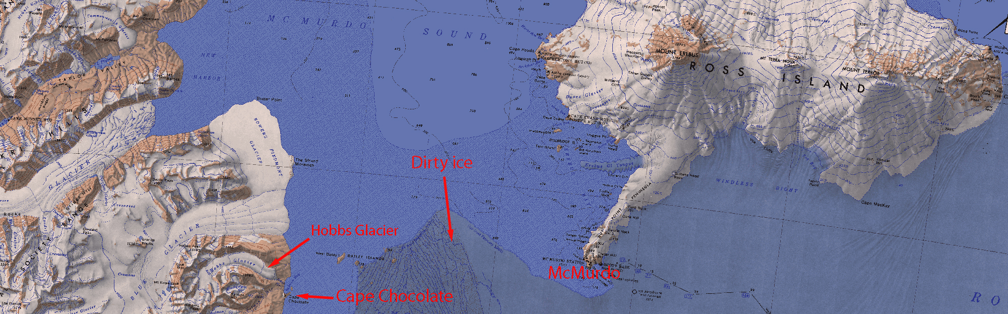 Map of the flight path across to Cape Chocolate from McMurdo, with described features labeled.
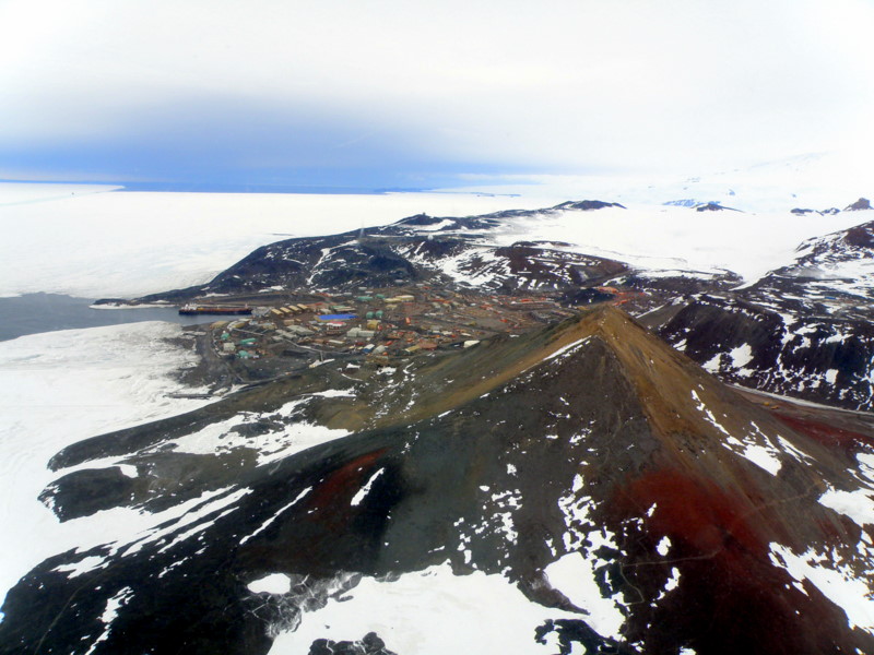
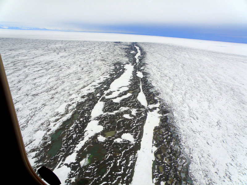
View of McMurdo and Ob Hill from helo (left) and dirty ice on the Ross Ice Shelf (right).
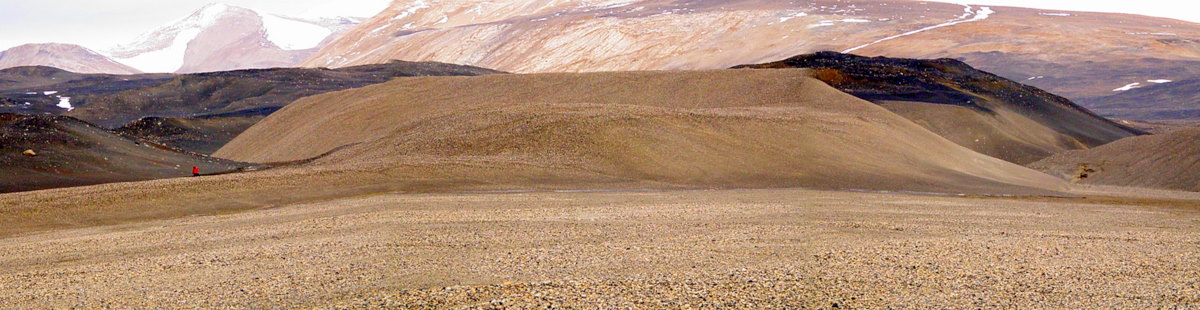
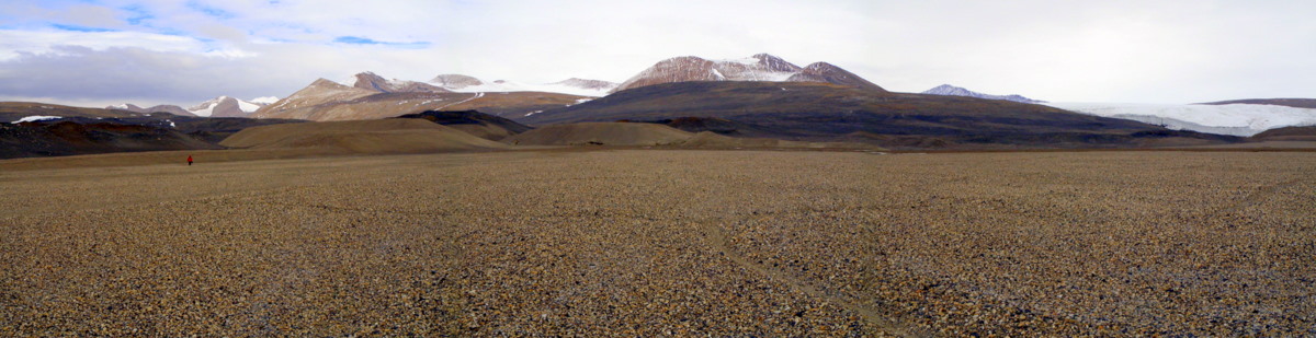
A tiny person (left) on a big landscape- moraine and delta of the Hobbs Glacier.
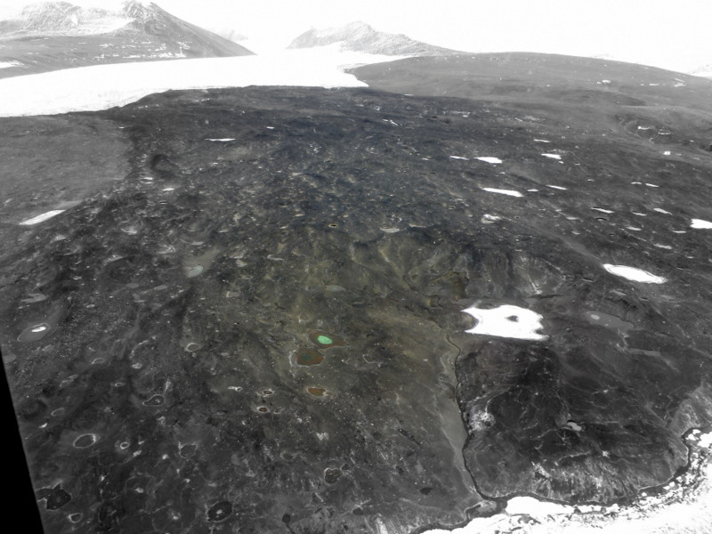
We started hiking south, with a plan to evaluate the access to the cape itself, and to survey for sites along the way. As we left the delta and gained the nearby hills, the nature of the landscape immediately became clear. All the terrain around us was composed of very recent morainal deposits; all loose, sandy, and although often capped by a desert pavement, no ornithogenic deposits existed. We quickly realized that this entire landscape was too young, and lacked important geomorphic features such as raised beaches and bedrock surfaces that virtually all known colony sites were situated upon. It would be extremely unlikely that evidence of ancient penguin colonies would ever be found here. But our survey revealed other fascinating features, very reminiscent of the Dry Valleys to our north. Small ponds dotted the surface of the morainal deposits, and each contained its own, unique ecosystem. Cyanobacterial mats coat the bottoms of the ponds, and often float on the surface, and the color of each pond is highly variable. Steve and I puzzled over how the original colonization took place, for these ponds were either formed from melting blocks of ice (Steve’s hypothesis) or from groundwater drainage through the sediments (my hypothesis)- in either way the water would have been the virtually sterile product of glacial melt.
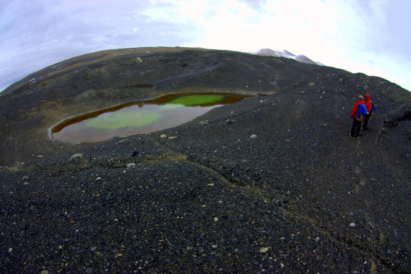

The moraine deposits that form the surface of Cape Chocolate (left) and ponds containing cyanobacterial mats (right).
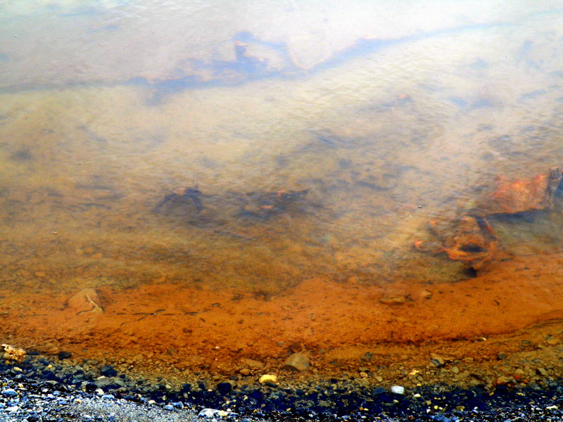
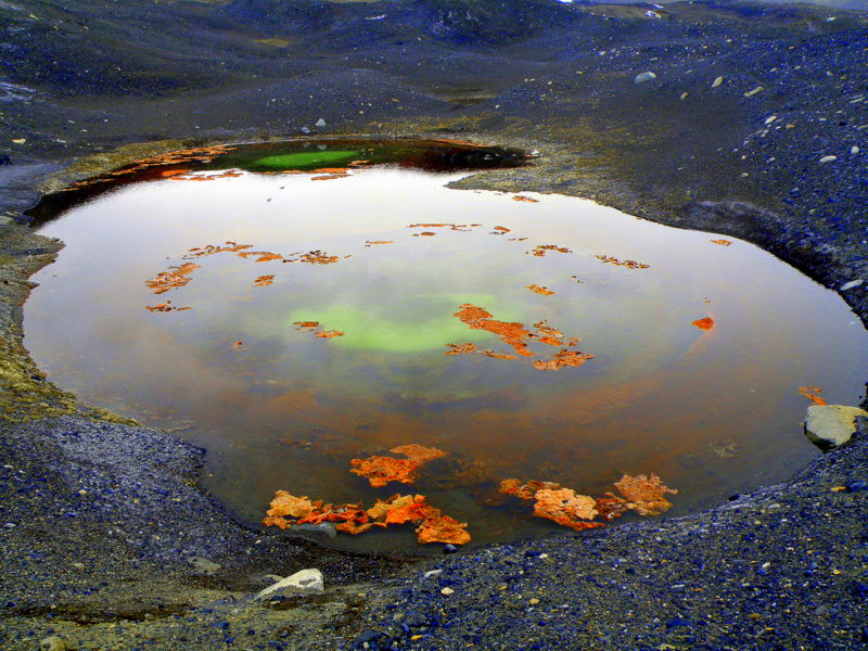
Cyanobacterial mats on ponds at Cape Chocolate.
Another resemblance to the Dry Valleys is the presence of active streams draining the glacier and subsurface reservoirs within the sediments. Elsewhere on the planet the presence of flowing water is normal and unremarkable, but this far south in Antarctica temperatures are almost always below freezing, and only unique microclimates in low albedo landscapes can produce enough heat to melt the ice and allow water to flow. This happens for part of the year in the Dry Valleys, and I would have to assume the melting and stream flow here is typical as well. But although the evidence is purely anecdotal, I have seen more flowing water this season than I have ever seen in the southern Ross Sea before. Jurek pointed out the proliferation of tiny mosses surrounding the streams, at least two species of bryophytes were growing in these harsh environments.
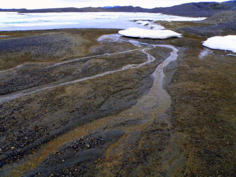

Active streams on Cape Chocolate, surrounded by moss communities.
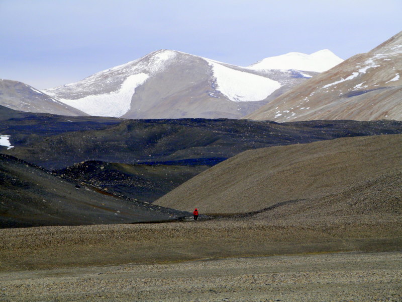
Within a couple of hours we had seen enough to strengthen our belief that no abandoned colonies would be found anywhere in this vicinity. But the hiking was pleasant, the views very spectacular and we were reassured by the continued visibility across the sound to McMurdo allowing our pick-up to occur as planned. Both Steve and I were impressed with how obvious the geomorphic processes are on this landscape. We both agreed that if we could beam down a classroom of students our jobs in teaching glacial and periglacial processes in geomorphology, primary succession in biogeography, or simply about polar climates in introductory classes would be easy. The landscape is stark and raw, and since the processes are in motion their mechanics are obvious. The retreating snout of the Hobbs Glacier deposits glacial till that is washed downstream by melt water, and deposited in a broad delta extending into McMurdo Sound. Huge, hulking moraines mark the terminal positions of the most recent advances of glaciers. Frozen ground fractures into geometric patterns of polygons from the expansion of ice crystals within the porous ground. And there is no vegetation taller than a few millimeters to obscure the ground beneath, providing truly textbook illustrations of the processes.
Snout of the Hobbs Glacier.
Delta of the Hobbs Glacier.
Textbook examples of post-glacial geomorphology (left) and periglacial processes (right).
As our pick-up time approached, we regrouped on the delta and put on our ECW for the flight back. When the helo arrived, we asked for flight up the coastline to the Blue Glacier for reconnaissance. The pilot was happy to oblige, and we soon saw that the entire coastline was identical to what we had already seen, so we’re pretty secure in dismissing the likelihood of ancient nest sites in this area. We turned east, and flew the 30 miles across the sound back to McMurdo. Although we didn’t find any new sites, it was interesting and exciting to visit a place that has obviously seen very few human explorers. Now we are getting ready for another day trip tomorrow to revisit Marble Point (this was our very first locale to investigate in the Ross Sea back in 2001, so we look forward to viewing again with more seasoned eyes). On Wednesday we will go out on the icebreaker to Beaufort Island. Stay tuned for more updates.
Cheers! Larry