Update #6: Two days at Marble Point (and visit to Tent Island)
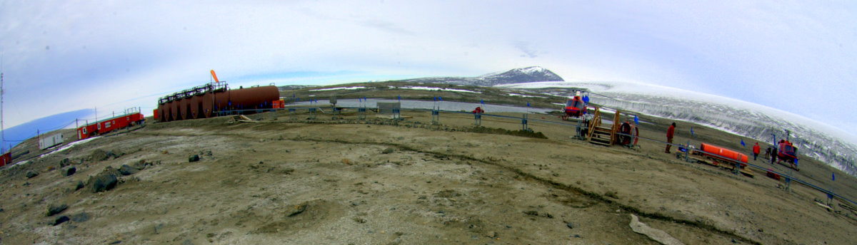
We just competed two more days of field work, across McMurdo Sound at Marble Point. First, a little background on Marble- for Raytheon employees, Marble Point may be the best kept secret in the US Antarctic Program. A small facility is situated there (actually on Gneiss Point north of Marble Point) that consists of a small but cozy hut, several outbuildings, and some very large fuel tanks. The station is a refueling stop for helicopters working in the Dry Valleys or up the coastline to the north. The station is manned by 2 fuelers and a chef, but the secret is how idyllic this assignment is compared to any in McMurdo- you are on your own, far removed from the big base (60 air miles), and many miles of coast line are exposed for hiking and exploration, all set between the spectacular snout of the Wilson Peidmont Glacier and a rugged coastline. And because of almost daily visits by helos, resupply is frequent and easy. In my opinion it would certainly be the best place to work in the southern Ross Sea.
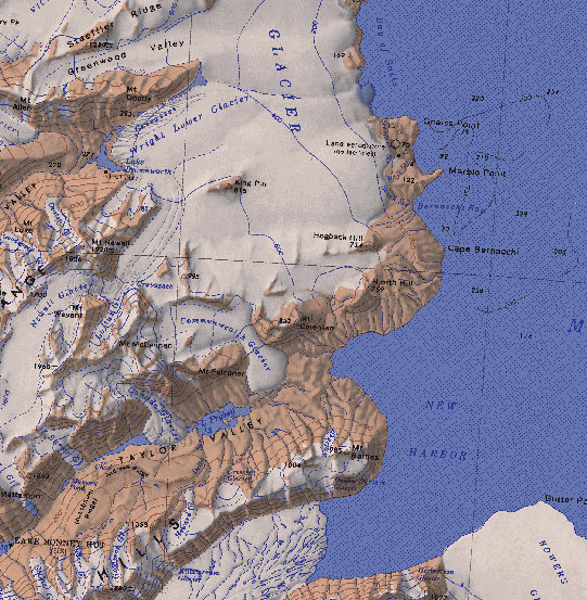
Location of Marble Point, adjacent to Taylor Valley (left) and the Marble Point Station (right)
Marble Point has a very interesting recent history- in the waning days of the Navy’s involvement, and as the NSF was starting to take over Antarctic operations, a plan was concocted to move the entire facility at McMurdo over to Marble Point. The main attraction was the room to construct a hard surface runway for transport aircraft, so the snow and ice runways that serve McMurdo today would be a thing of the past (hundreds of thousands of dollars are spent every season maintaining those runways). From previous visits I remembered seeing a master plan of the facility, and I asked about it again this time. Work was begun (hence the dozer cuts, dammed pond, and construction debris that litters the Point), but eventually halted when it was discovered that the harbor was too shallow for the draft of the transport ships required to resupply the base. If not for that bathymetric factor, we would be working from Marble Point today instead of McMurdo.
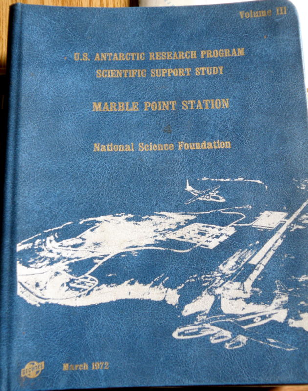

The Marble Point master plan, circa 1972 (left) and the master plan map of the 2-mile-long runway and facilities (right).
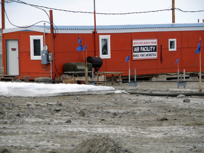
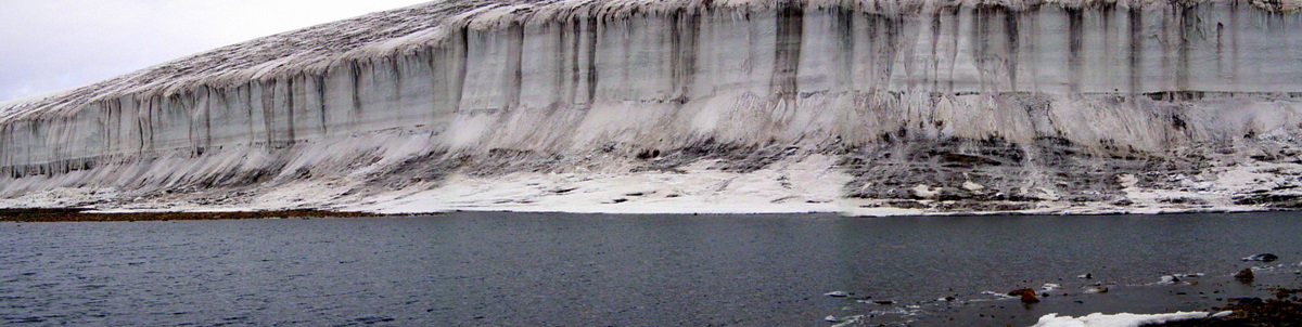
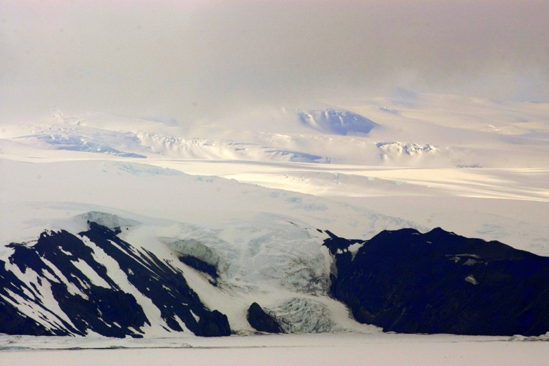
Setting of the present Marble Point Station, near the Wilson Piedmont Glacier (right).
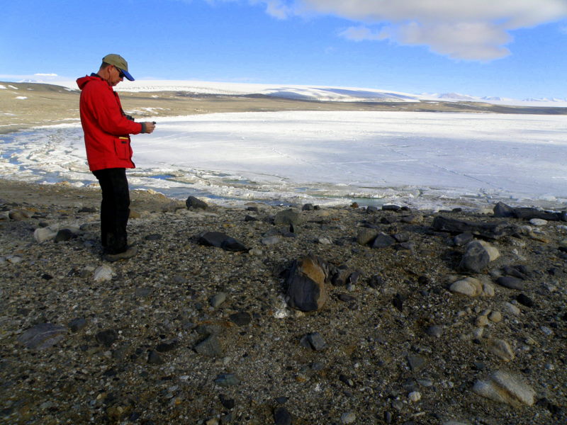
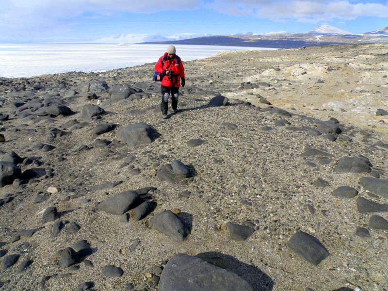
We have some history on Marble Point as well- this was the first Ross Sea site we visited for field work in 2000, so the first place I set foot on the Antarctic Continent (Ross Island and the Ross Ice Shelf are all most people ever see), and the first place we had a field camp (a mellow start since you could run screaming to the station for help if you got scared). We found the southern-most abandoned sites here on the Victoria Land Coast, and excavated several test pits that provided occupation ages of 2000-3000 years ago, during the last of the Penguin Optimum. We returned this season both to survey for sites we may have missed since our search pattern was just developing then (we’ve seen so many more fossil sites now), and to give Liu the opportunity to sample sediments from around the ancient colonies. We easily relocated our test pits from 2000-2001, and walked east onto the point to look around. I’m sure we were out here 10 years ago, but somehow we missed the extensive evidence of occupation south and east of where we had worked. In fact, the site we discovered this time was much larger than our previous site, and must have been the main occupation of the point. Steve probed into a few mounds and was able to recover a few feather fragments for dating, but the deposits were very old and preserved material sparse, so we probably won’t add much to the record from here. Jurek found some mosses growing in a moist micro-climate on the north side of the point, probably thriving in response to nutrients leaching down from the abandoned sites. We mapped the site for future reference.
Steve relocating a test pit from 2000 (left) and Jurek surveying part of the extensive new site (right).
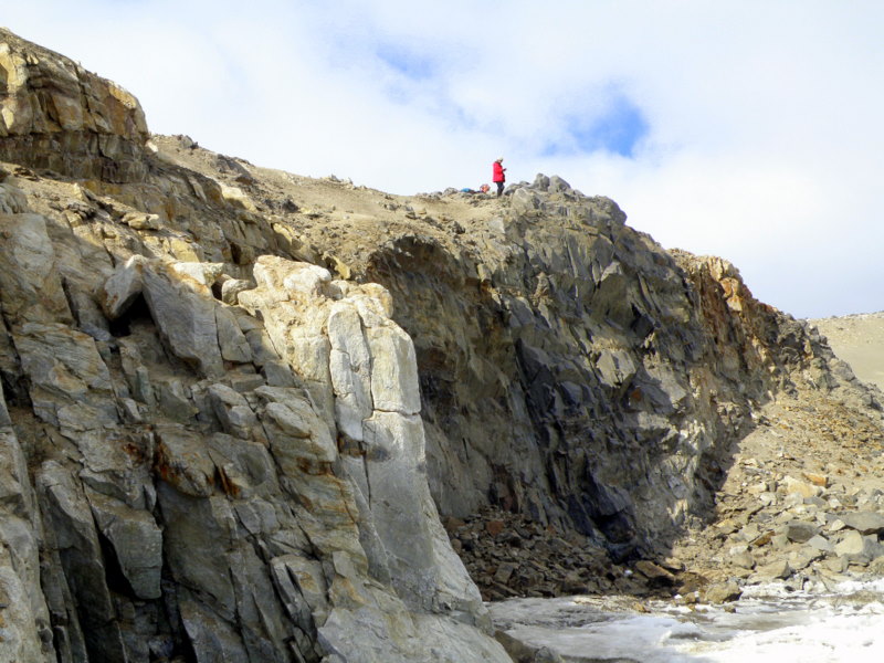
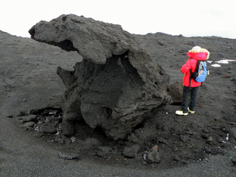
As we surveyed the rest of the point, two themes struck me about the rich history of Antarctica revealed on the landscape at Marble Point. One theme concerned geologic events in the distant past- evidence of the intrusion of magmas during the Ross Orogeny 500 million years ago is abundant here. Dark intrusive veins criss-cross the point, and the marble for which the point is named was formed by limestone country rock coming in contact with these magmas. These magmas were injected when the younger tectonic plate that underlies West Antarctica today first collided with the ancient crust under East Antarctica. Rocks were folded and deformed by this collision, thrusting up the Transantarctic Range, injecting magmas, and metamorphosing sedimentary rocks that covered the continent.
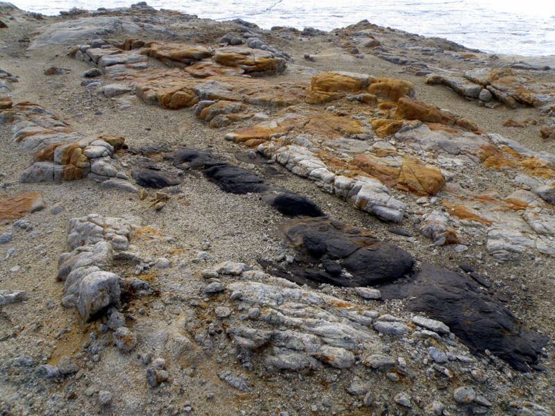
Jurek examines mosses on top of a black, diorite dike (left) and details of intrusive dikes cutting through metamorphic rocks (right).
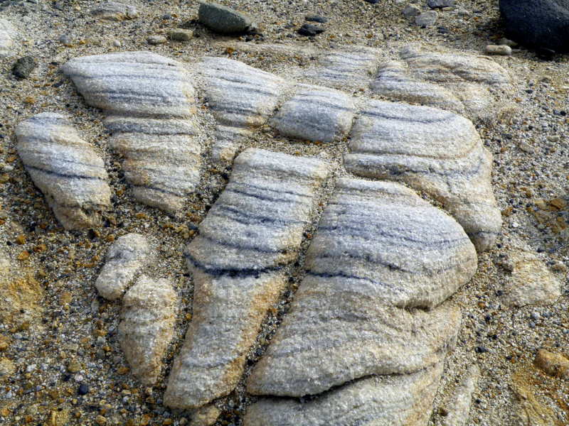
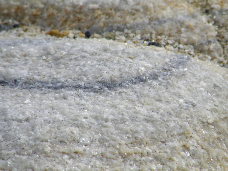
Marble, the product of baked limestone, at Marble Point.
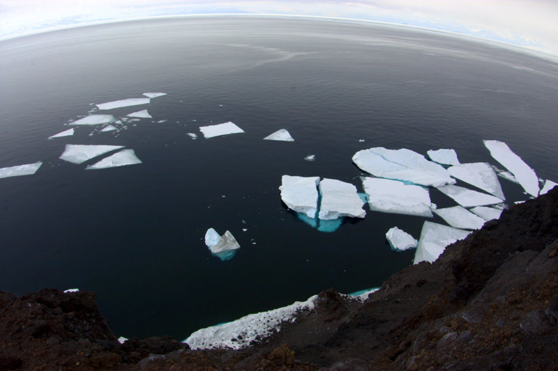
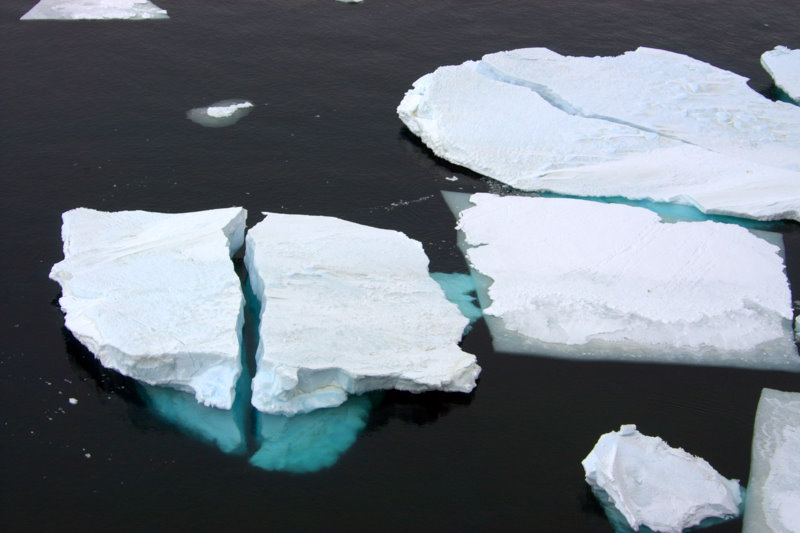
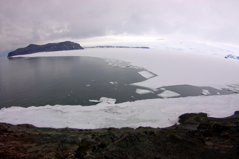
The second theme involved Antarctica’s frozen legacy- evidence of the dynamism of ice is apparent everywhere. I spent a few minutes down on the seashore and watched and listened to the wave action at the fringe of the sea ice. The motion is generated many kilometers away in open water, and then propagates under the solid surface of the ice, the energy eventually emerging into the narrow moat between the ice and shore. The sea ice makes amazing noises- groans, high-pitched whines, and cracks as it responds to the distant forces, and waves wash brash ice and icebergs to and fro as they break. Above the surf a record of glacial ice on land is preserved in the series of raised beach terraces that stretch above the beach. As the great weight of ice from the Wilson Piedmont Glacier was removed from the land surface by retreat following the Last Glacial Maximum, the shoreline began to rise by isostatic rebound. Each raised terrace represents a short hiatus in that inexorable springing back of the depressed land surface, and the process is clear with such well preserved evidence. Above the terraces lies the present front of the Wilson Glacier- a piedmont glacier describes the sprawling front that a valley glacier assumes when the valley ends. The front of the glacier today is either static, or in retreat, and again the presence of meltwater ponds and running water in the streams below the glacier makes me fear the latter. The history of ice theme was also reflected in a large, tabular iceberg that was frozen into the sea ice in front of the point. This berg calved off a shelf somewhere in the Ross Sea (probably east of Cape Croizer), drifted around Ross Island, and then was frozen in place by last winter's sea ice formation. The Marble Point chef told us that it wasn't there last spring when she pulled out, so it must have drifted in just before the winter freeze commenced.
Waves breaking along shore after passing beneath sea ice.
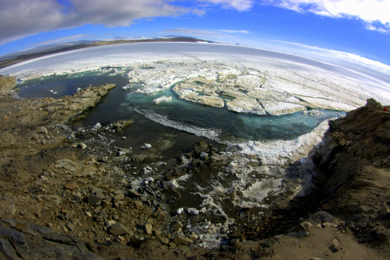
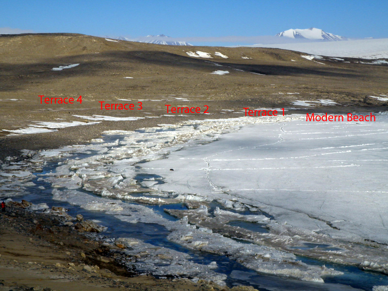
Dynamic sea ice and wave action below Marble Point (left) and raised beach terraces from isostatic rebound (right).
 Meltwater lake and front of the Wilson Piedmont Glacier.
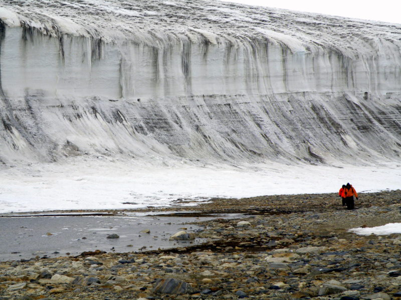
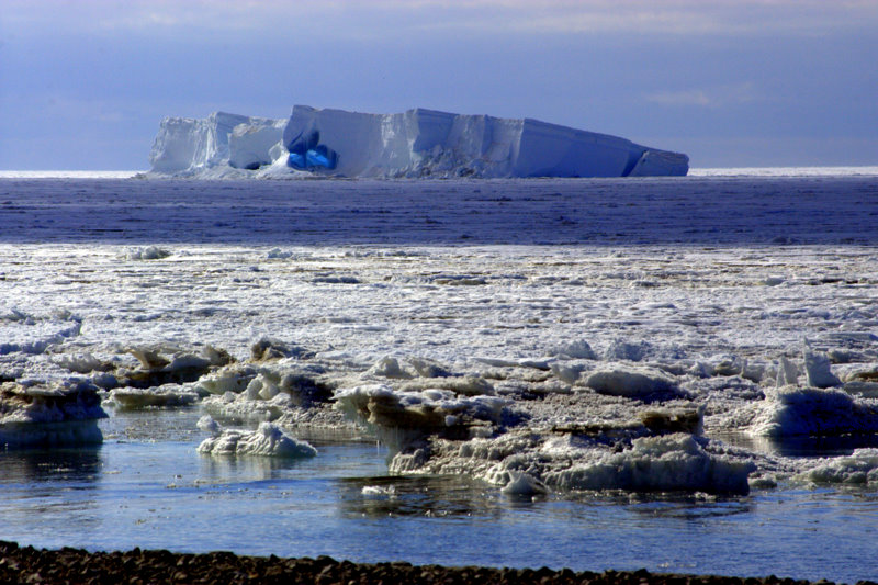
Hikers in front of the Wilson Glacier snout (left) and beautiful frozen-in iceberg near Marble Point (right).
We returned to the beach to check on Liu, and found that he was engrossed in sampling sediments from the ponded deposits between beach terraces below one of the ancient colonies. I finally grasped a least a part of his methodology as I watched- with some deft shovel work he pulls up a 25 cm or so long stratigraphic package from the side of a shovel hole. Then he carefully samples down the column by one-centimeter increments. He also utilizes a large-diameter PVC pipe as a coring device, pounding it into the sediments and sawing off at the level of the top of the sediment to bring home for analysis. He took us over to another deposit a terrace or two up and dug down to a light-brown layer 20 or 30 cm down. “Seal hair” he explained, and pulled out a sample for us to see. When he resampled this site with his coring device he found a second deposit deeper- evidence of the use of this beach by seals for molting sometime in the distant past (although I assume sedimentation rates would be exceptionally slow here, we don’t know how old these deposits may be until Liu gets dates back).
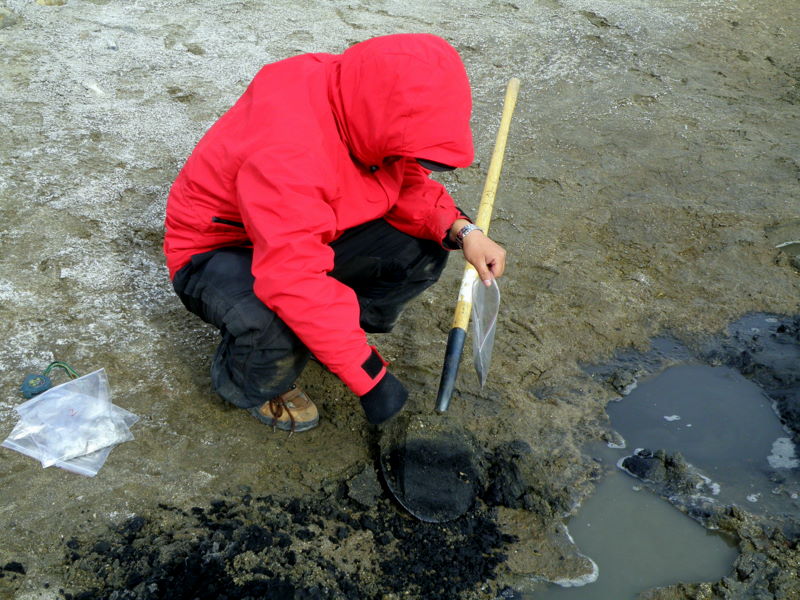
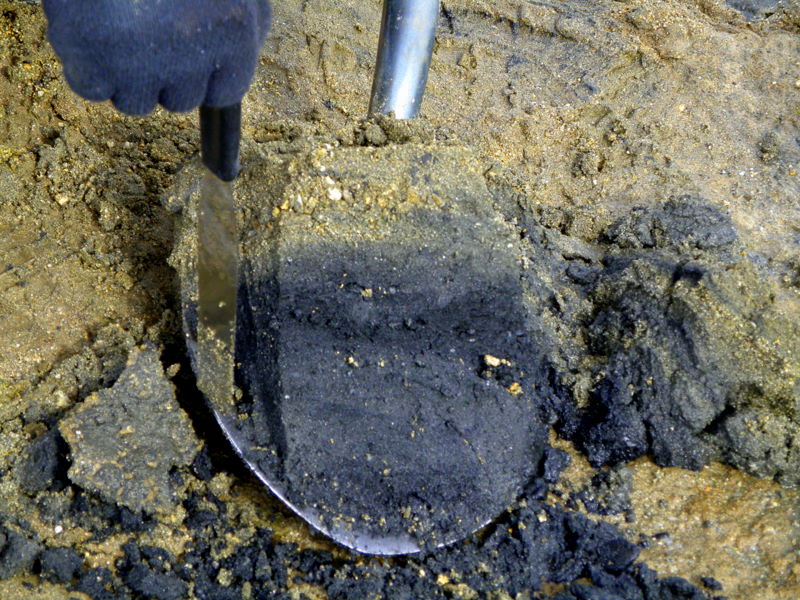
Liu sampling sediments at Marble Point (left) and a close-up of stratigraphy preserved in the sediments.
Soon we were back in 08 Hotel and heading for McMurdo. On the flight over the pilot and helitech had chattered non-stop about how thin the ice we were flying above was getting (and we all well know that means that a helicopter making a hard landing wouldn’t be supported). But going back Scotty apparently wasn’t concerned about it, and flew the ice edge to look for whales. We saw numerous orka, and several scenic tabular bergs surrounded by the kaleidoscopic patterns of disintegrating sea ice. As we neared McMurdo we saw the Oden working away at an ice crack to further open the ship channel.
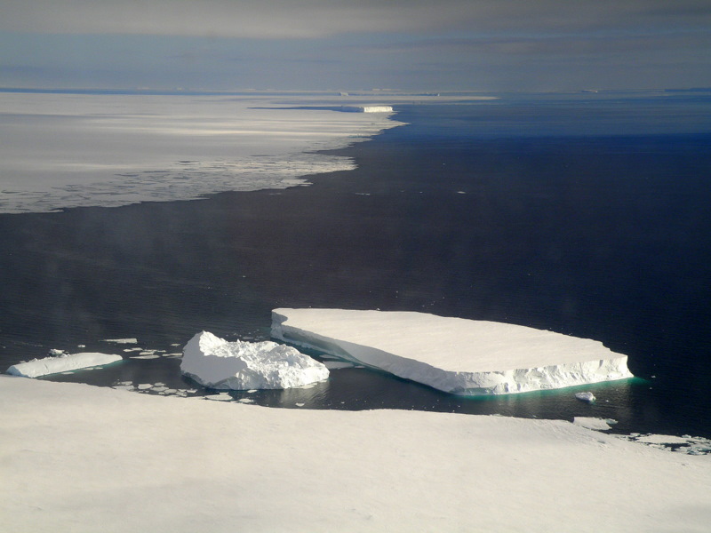
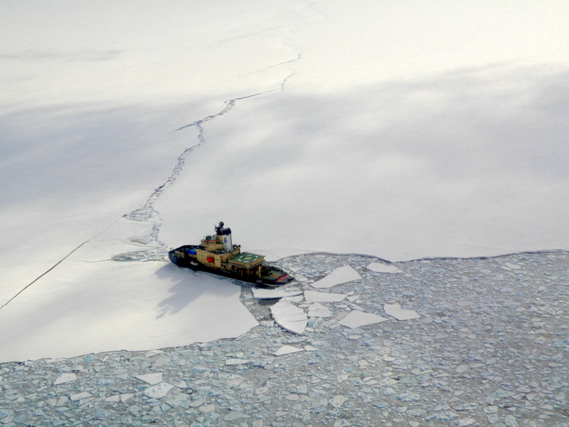
Tabular bergs off the ice edge (left) and Oden working on the ship channel (right).
On the flight back we also got a better look at Tent Island, off the tip of Cape Evans on Ross Island, and we decided that we should go survey it for sites (Cape Barne with the southernmost sites on Ross Island is just to the north). Since we already had a helo request for the next day, we decided Tent would be our objective. But the next day dawned cold and very windy, and Scotty informed us that Tent Island would be miserable in these conditions, so he asked whether we had an alternative plan. Since Liu did want to return to Marble Point with his coring rig, and we also had a crew of boondogglers with us, we decided to go back to Marble Point. I should explain- as a reward for a season of hard work at McMurdo the management offers empty seats on helicopters that are heading to nearby field sites to workers as their names come up on a list. They simply get an email the night before, and know to show up for their flight at an allotted time. We had three guys joining us for the day, and I told them that Marble Point would have more to see and do than Tent Island anyway. From their attention at the helo safety briefing it was clear they hadn’t flown in helicopters before, and we gave them the window seats for the ride. We dropped off Steve and Lui near the point to return to Liu’s sites from the previous day, and one boondoggler (Mike) went with them. The rest of us flew to the fuels station since Jurek wanted to look at the vegetation around lakes near the station. I guided the boondogglers around a bit- showing them the glacier, the beach terraces, and the frozen-in icebergs. Soon we burned through our time, loaded up again on the helo, and flew down the beach to pick up Steve. I had forgotten from previous seasons that Scotty is a bit of hot-dog in the helo, he really punches it right off the pad. On the flight home he flew the ice edge again, and we saw several more orka along the way. When we arrived back at McMurdo, one boondoggler, Chris, thanked us for the highlight of his season on the ice. It was a good reminder for me about how lucky we are to see so much of the continent in our project- even a rather mundane trip for us to Marble Point is very exciting to most folks that make it down here.
Next day conditions were much calmer, and we were scheduled to try for Tent Island again. There was some confusion at Helo Ops over whether the ice had broken away from Tent, meaning that it would be inaccessible because of the prohibition on flying over open water. But Scotty assured us it was fine, and we loaded up with three more boondogglers in tow. There is a weather station and comms tower on the summit of Tent, so we landed at the helo pad up there. Steve, Jurek, and I split up and went in three directions to survey the island. It was soon clear that although penguins could have negotiated the slopes around most of the island, it was rather steep and other sites would have been much more attractive. With no sites to investigate, we took in the spectacular scenery around us- bizarre ventifacts carved from the dark volcanic blocks on the slopes, the sea ice edge stretching over to Inaccessible Island and Cape Evans, and views of Erebus and its glaciers emerging and disappearing from the clouds around it. We kept an eye out for historic artifacts, since we were sure heroic-age expeditions must have visited the island many times, but none were apparent. After a few hours, we heard 36 Juliet approaching the pad, and soon we were heading back to McMurdo once again. The whales were active along the ice edge, and from my middle seat I actually saw one breaching, a sight I haven’t seen before, but it was over before I could power up the camera to shoot.
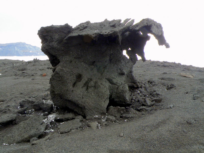
Ventifact on Tent Island, with boondoggler Mia for scale (right).
Icebergs in the open water alongside Tent Island.
View to the northeast from Tent Island along the ice edge, Inaccessible Island and Cape Evans in the distance (left), and view to the east of the slopes and glaciers of Mount Erebus (right).
Tomorrow the long-awaited icebreaker trip to Beaufort Island is scheduled, and with a long day ahead of us we are readying the gear. I’ll write again when we get back.
Cheers! Larry