Day Trips and a Ride on the Icebreaker
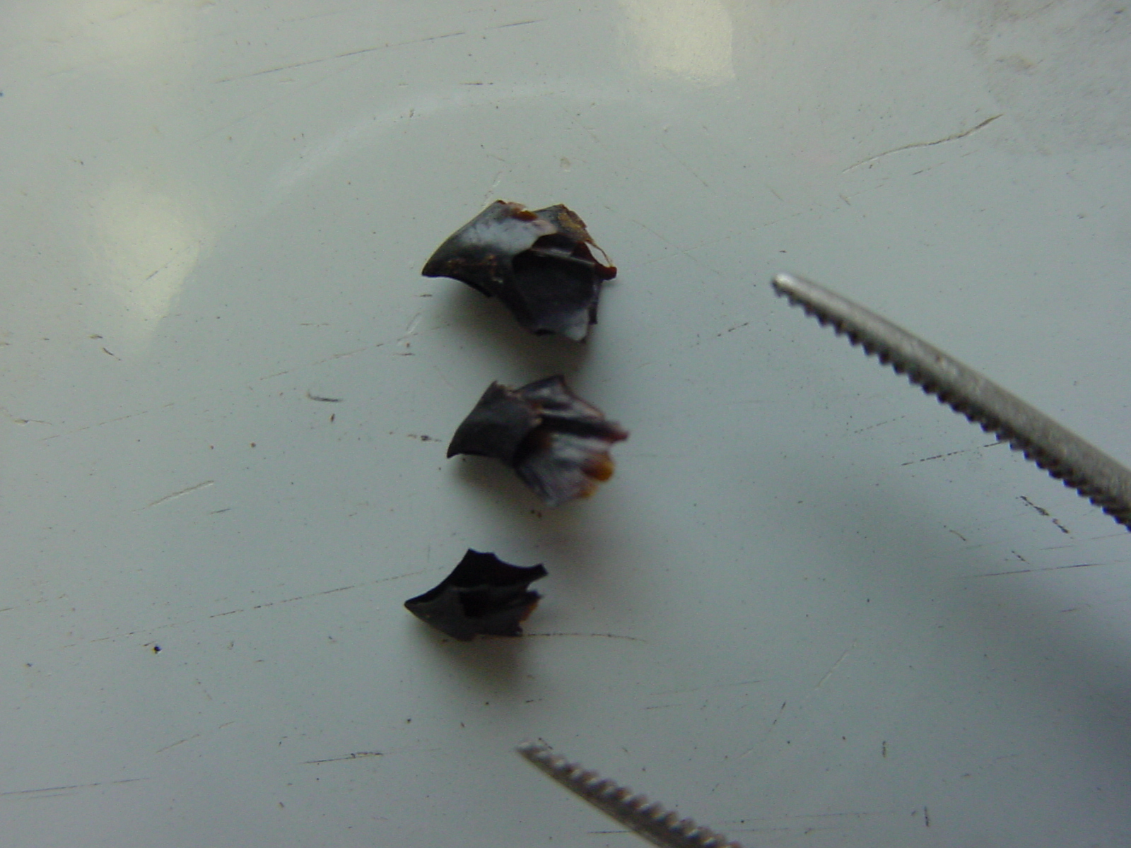
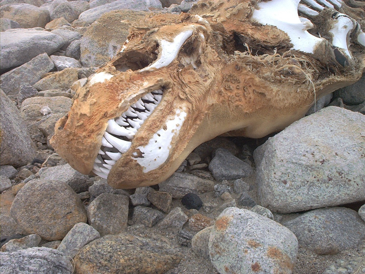
As I mentioned in my last update, our field camping days have ended for this field season, and we now shifted our methods to conducting surveys of potential sites and excavating quick test pits while being supported by helicopters on day trips. Day tripping is a much less involved activity utilizing the smaller ships, the A-stars; we only have to load our personal gear and excavation tools into the basket, and jump aboard for a pleasant flight to our destination. The view from inside the A-stars is much better as well, as demonstrated by this short movie clip of a helicopter ride shot by Mike. Our first trip was a return to Marble Point, our very first site, to take a GPS reading of the beach terraces, as we did not have the equipment at the time we worked there. While the reading was taken, Steve and I re-visited the mummy of a crabeater seal we had found earlier to take some digital pictures. The dentition of these creatures is amazing; supposedly the most derived or specialized of any mammal. The many loops and curves allow the seal to scoop up mouthfuls of seawater full of krill, and filter out the food while expelling the water. Compare these teeth to those of a leopard seal we found at Spike Cape. Leopards are the only natural predators of penguins, and their teeth are adapted to holding tightly to the birds while thrashing them around on the surface to remove feathers and skin. We found dozens of seal mummies as we surveyed the beaches during our work, but most were Weddell seals.
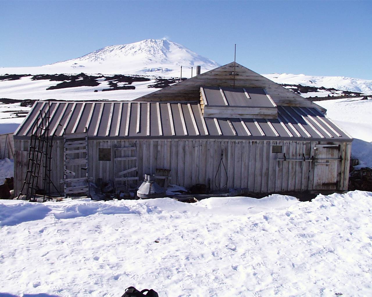
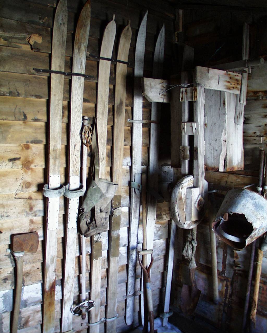
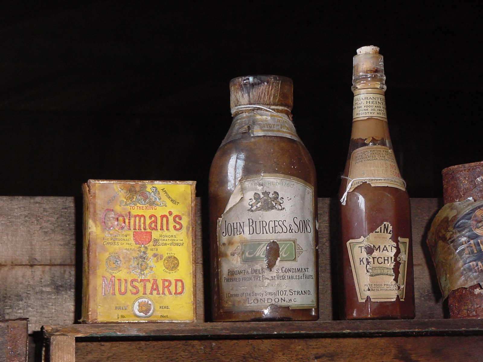
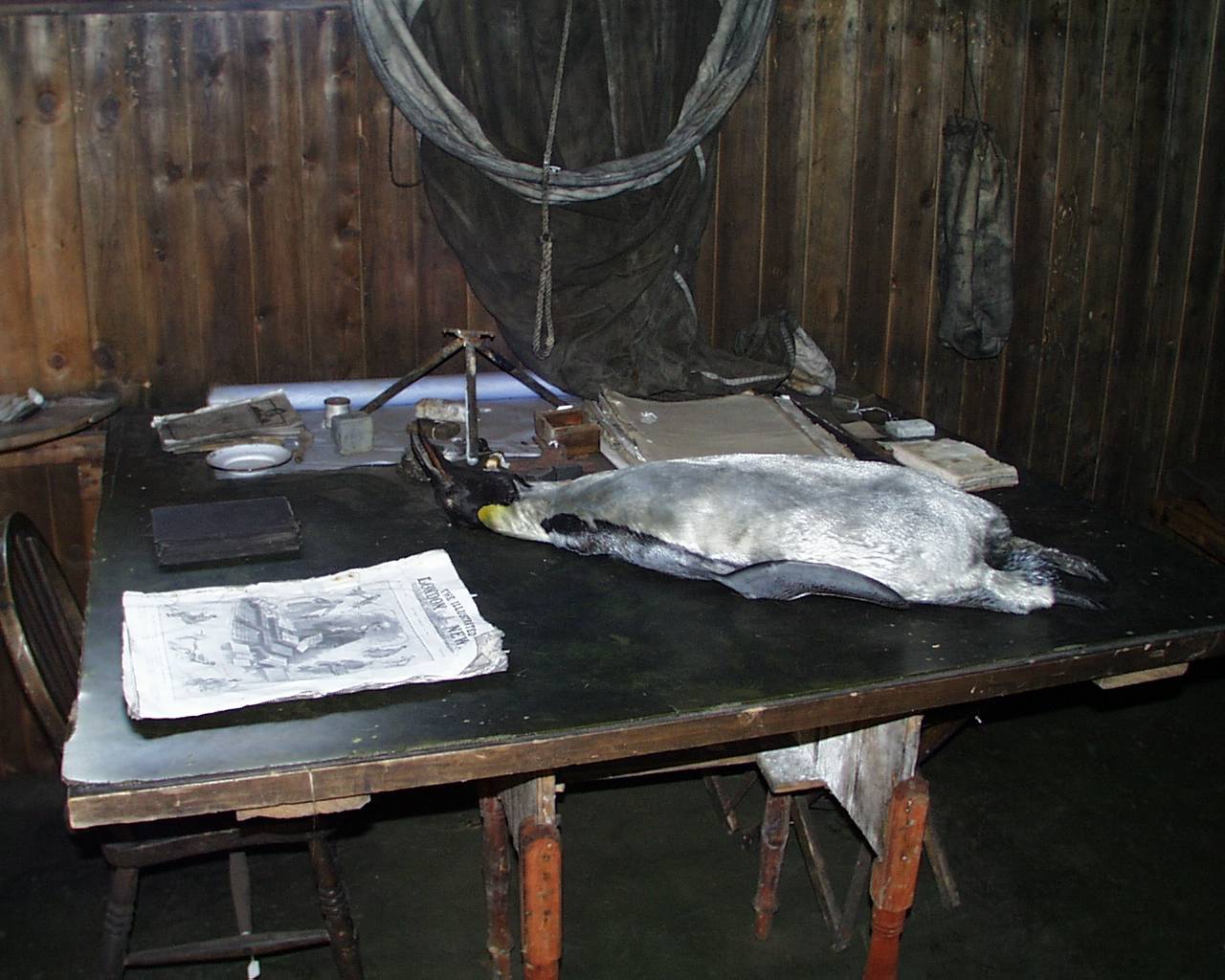
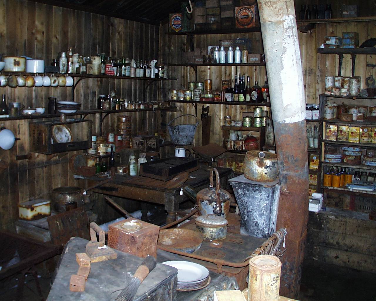
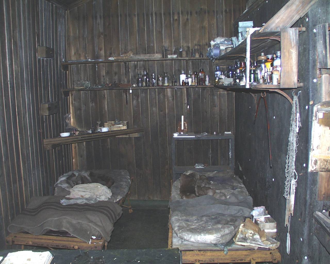
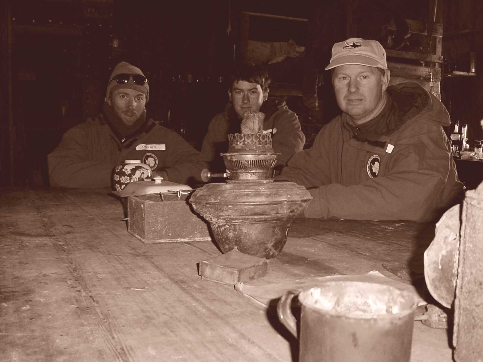
In the afternoon, we were picked up and flown across McMurdo Sound to Cape Evans, the next point south of Cape Barne, to survey for potential sites. Interestingly, Cape Barne appears to be the farthest south that penguins established rookeries, for we found no fossil colonies on Cape Evans. This provides an important data point for sea ice extent in the Ross Sea in the past, as Cape Evans must hold onto sea ice too long on average for Adélies to breed there. We did have a dual agenda in visiting Cape Evans. This is the site of Robert Scott’s other hut, the base camp that he failed to return to on his final expedition to the South Pole. Even after visiting Scott’s Hut Point Hut, and Shackleton’s Cape Royds Hut, I was amazed and delighted by the Cape Evans Hut. For starters, this is apparently the least disturbed of all the historic huts on Ross Island, so a tremendous number of artifacts from the heroic age are perfectly preserved in the hut, such as these skis, these condiments, and this emperor penguin specimen collected by the Scott party. But what I found most impressive was how much more livable this hut was in comparison to the others. Far from being small and dingy like the others, this hut was spacious and comfortable. Small cubbies around the perimeter provided space for a scientific laboratory, a darkroom, a library, and a kitchen occupies one whole corner. Bunks are arranged in small clusters that make for a comfortable sleeping arrangement (I could never quite figure out where more than two or three people would sleep in the other huts). Research by the Historical Society has determined who slept where, and a map depicted which bunks belonged to which specific legendary figure. It was from this hut that the monumental wintertime journey to Cape Crozier was launched, that sent Bowers, Wilson, and Cherry-Garrard on the “Worst Journey in the World” to the grim stone igloo we had visited there (see Update #3). We reenacted a photo taken upon their return to the hut in the exact positions around the huge central dining table that they had occupied. It felt as though you had traveled into the past and had become a part of history. Outside the hut the skeleton of a husky is still chained to his doghouse, and the great anchor that held the Aurora before she broke her chains and was set adrift in 1915 is still hooked solidly into the beach. We spent more than an hour in and around the hut, and then flew back to McMurdo for the evening.
Click on the images below for a larger version.
 |
 |
 |
 |
 |
 |
 |
 |
 |
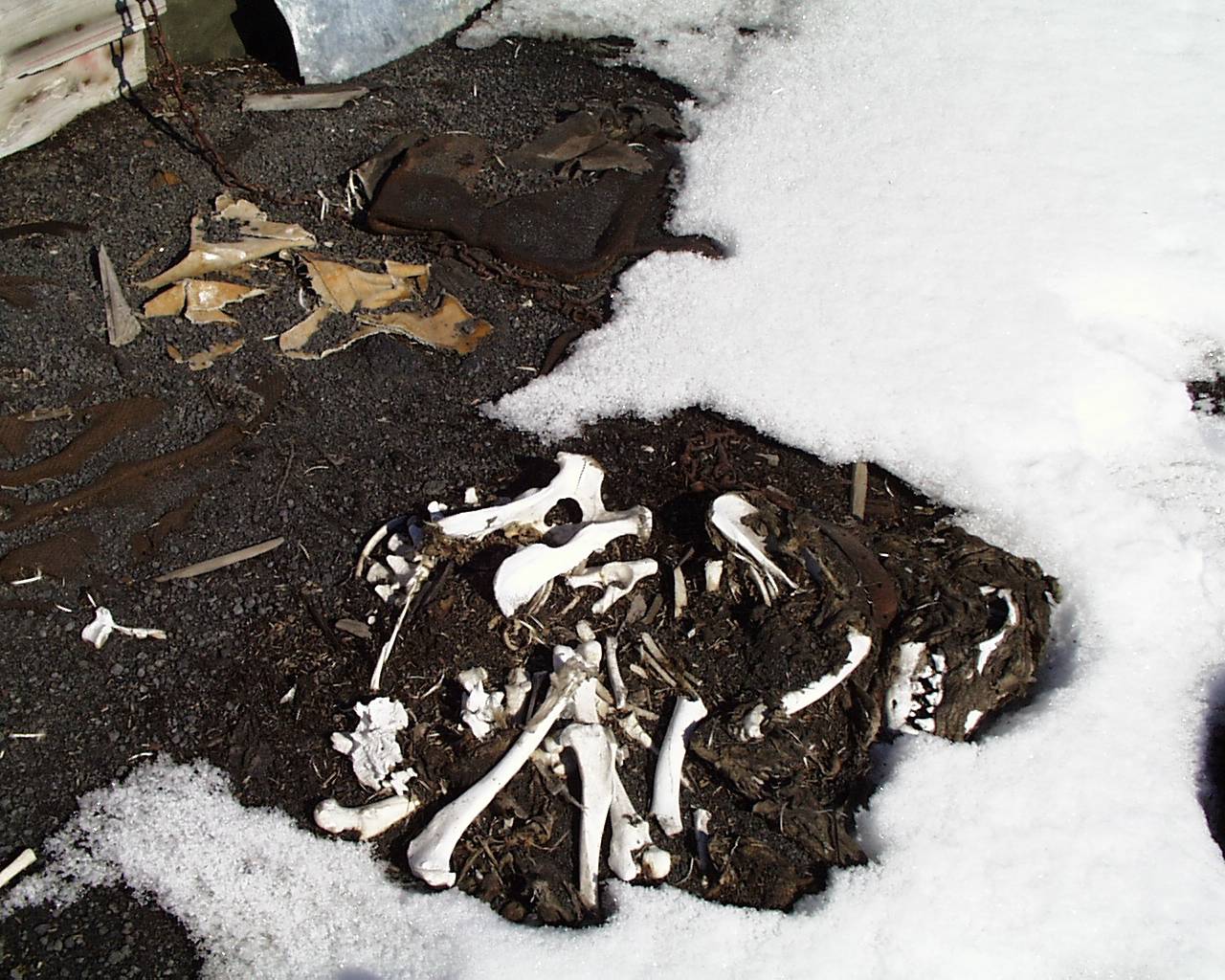 |

Above: Comparision of the dentition of crabeater seals (Lobodon carcinophagus) and leopard seals (Hydrurga leptonyx). The Terra Nova Hut from the final Scott Expedition at Cape Evans, and several views of the artifacts inside and out: skis, condiments, Scott's bunkroom table with Emperor penguin skin, the galley, and the crew's bunks. Our reinactment of the famous Ponting photo of the team returning from the Worst Journey in the World, a huskey skeleton in front of the hut, and the Aurora anchor from the final Shackleton party still buried in the gravel after the pack ice pulled the ship away, breaking the anchor chain.
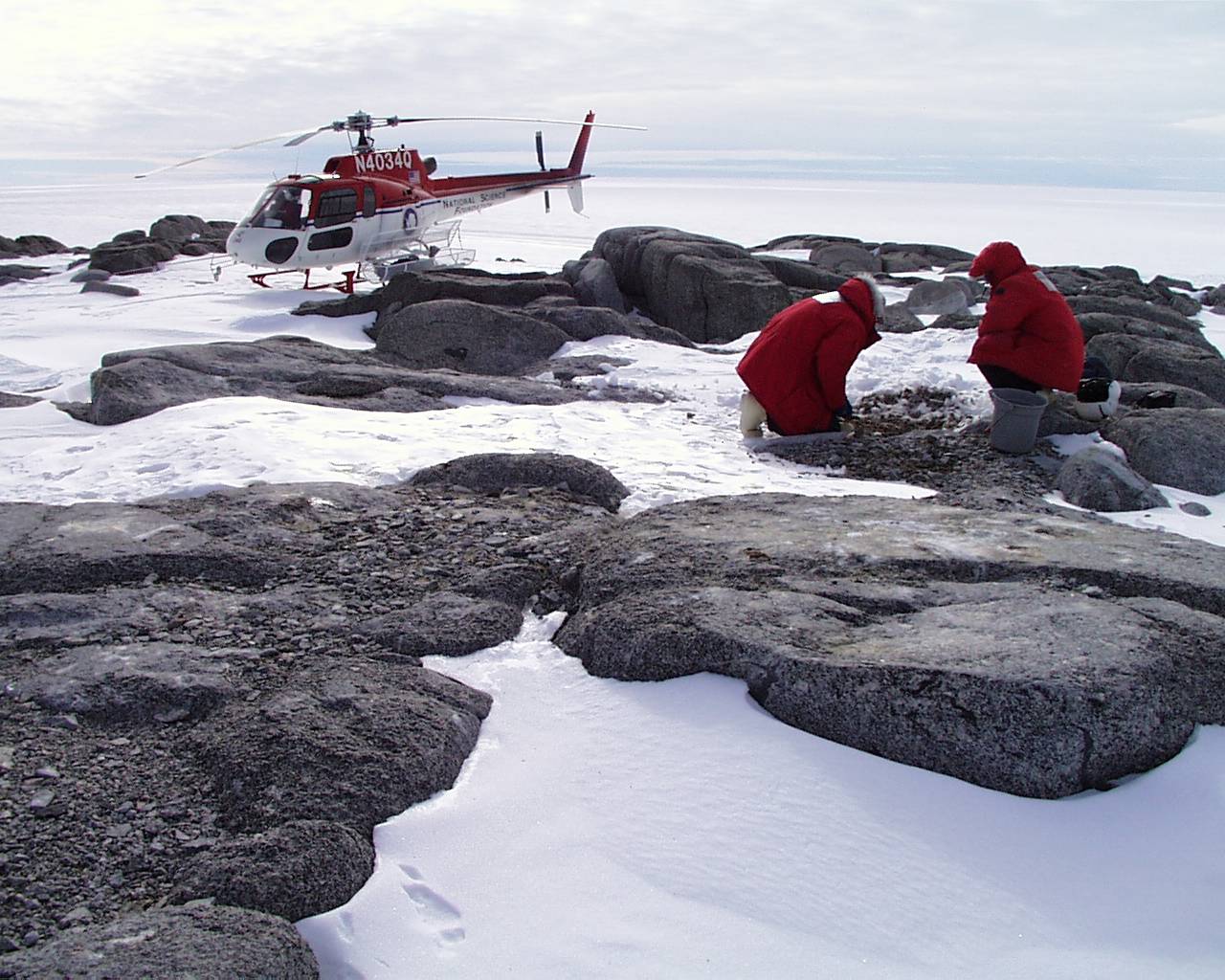
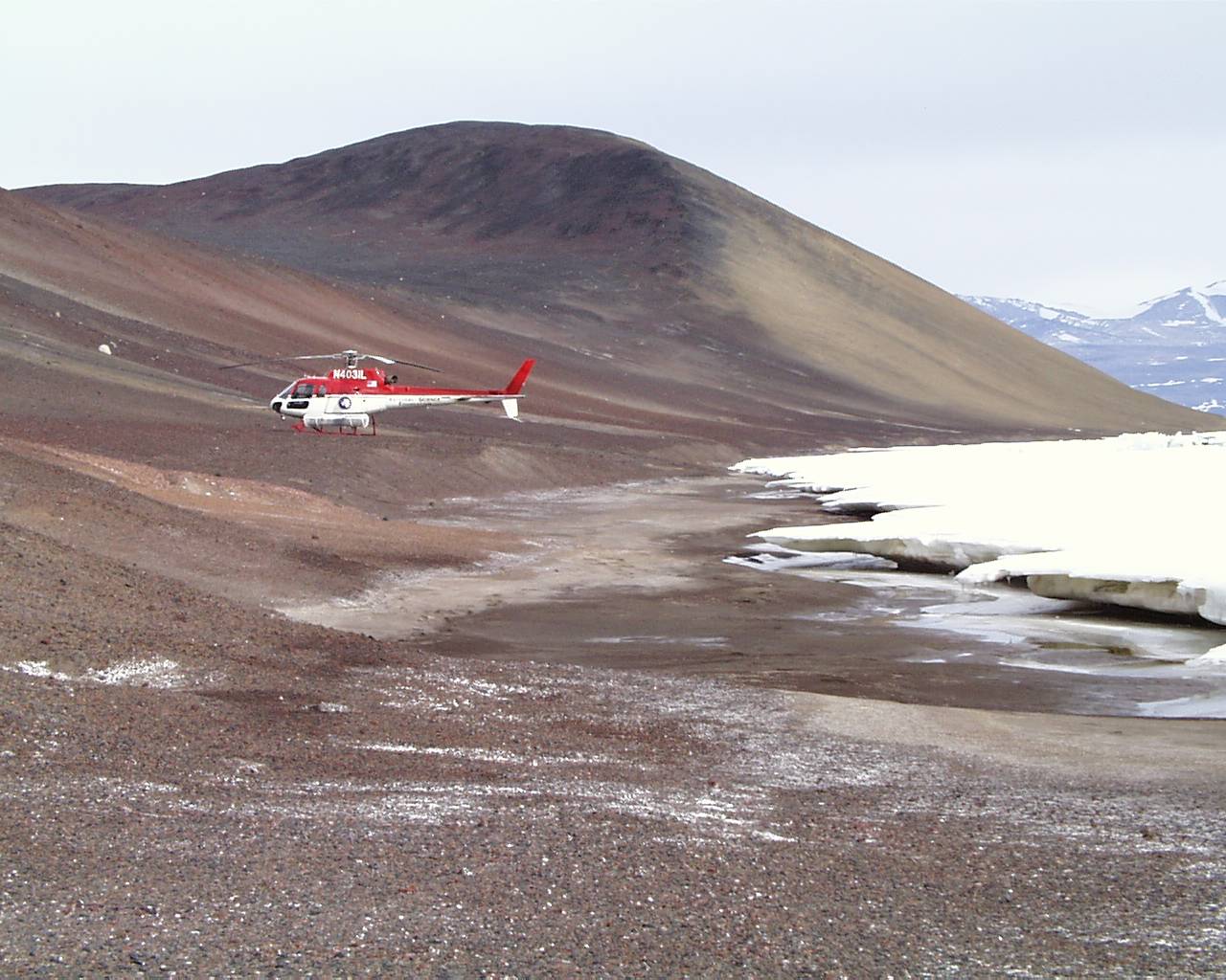
The next day we had scheduled a return visit to our most northern two sites- Capes Hickey and Day, which we had earlier found too snowy for an extended visit. We wanted to see if the snow had cleared off enough to allow us to locate abandoned colonies, but that was definitely not the case. As before, Cape Hickey was barely visible above the snow, as a series of tiny rock islands jutting out between glacier and sea ice. It was far more comforting to survey the exposed surfaces with our faithful A-star on-site as well, as it was still clear that camping here would have been neither pleasant nor fun. Steve had given up on finding any sites on the limited terrain, and was returning to the ship when I made an interesting observation. One surface of the gray granite was littered with silver dollar-sized pebbles of red granite that had to come from more than 10 m away, I suspected penguins as the mode of transport. When I probed below the pebbles, I realized that the sediments were deeper than they looked and were definitely ornithogenic. I called Steve back, and we excavated the small site, recovering about a bucket of matrix. We attempted to excavate another similar site at the most northern rock island, but the sediments were frozen solid, and were only slightly softer than the granite when struck with a hammer! We remain mystified as to the location of the test pits excavated by the Italians. Their paper notes thick accumulations of ornithogenic soils, as much as 35 cm in depth (Baroni and Orombelli, 1994). And this was also the site that dated to the late Wisconsinan (13,070±405, based on a bulk sample of guano), so it is important to re-sample the site, but conditions this year will not allow it. It is hard to believe that any deep sediment layers could exist below the snows, but perhaps a warmer season would reveal a very different character. We reboarded the A-star, and headed south for Cape Day. We were again confused, as Cape Day itself is nothing but a tiny rock outcrop between lobes of a glacier, but just south of the cape an unnamed point proved much more extensive. Could the Italians have misidentified the site? Or again was there much more to Cape Day concealed by snow? Answers to these questions will have to await further information. We touched down with some caution, our pilot Cady Johnson landing in the saddle between the glacier and the unnamed point and where glacier stopped and snowfield began was indistinct. We found no sediment at all here, so after a thorough search of all possible nooks and crannies, be reboarded for the flight home. On the way back we flew over Cape Roberts and Spike Cape, and exposed beaches on both looked promising for surveys later in the week.
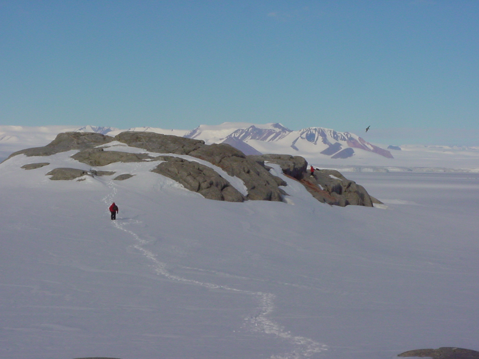
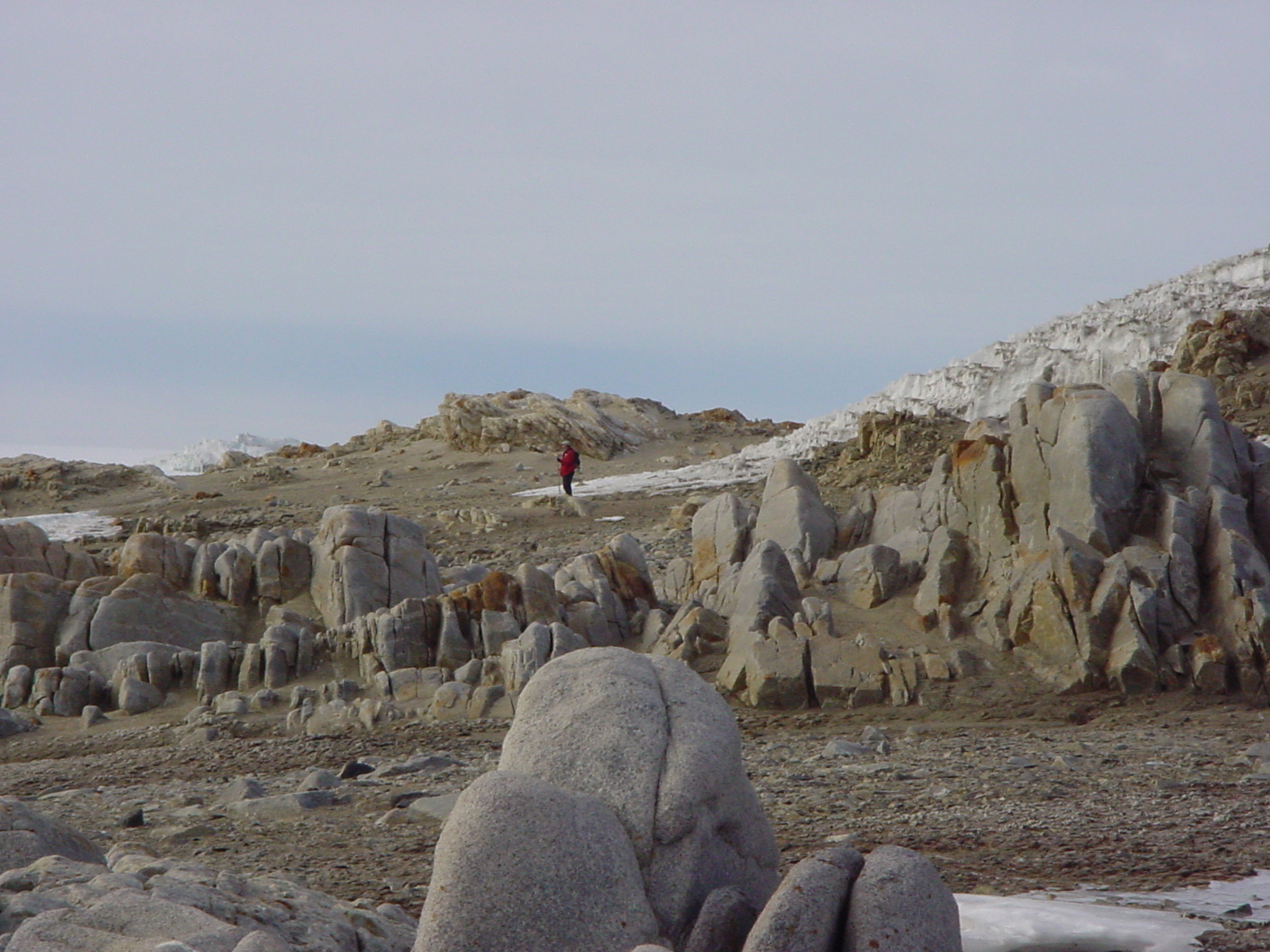
Next day found us rotoring to Cape Bernacchi, a long strand beachline that connects Marble Point to the Taylor Valley, one of the famed Antarctic dry valleys. As we flew along the shoreline I marveled at the acres of patterned ground, deep polygons etched into the landscape in most periglacial terrain with deep sediments. We were dropped off just south of Marble Point with our survival bags (pre-packed duffels containing tents, stoves, fuel, pots, sleeping bags- all that we would need if the helicopter couldn’t return), and began walking south around Cape Bernacchi towards New Harbor. As on the eastern side of the Sound we found no sites, providing evidence that Marble Point represents the southwestern extent of penguin breeding in the region. As the day was pleasant and we had prearranged with our pilot John Loesure to pick us up down the beach, we hiked six or seven miles to Explorer’s Cove, the northern extent of New Harbor, and got a great view of the Taylor Valley. As we waited for the helicopter, I walked towards the water on the beach and got a surprise when the ground I was walking on began to jiggle and sink! I rapidly backtracked and found that the sediment underfoot was saturated and behaved like the “whale-belly” I have experienced in slot canyons of the desert southwest.
 |
 |
 |
 |
 |
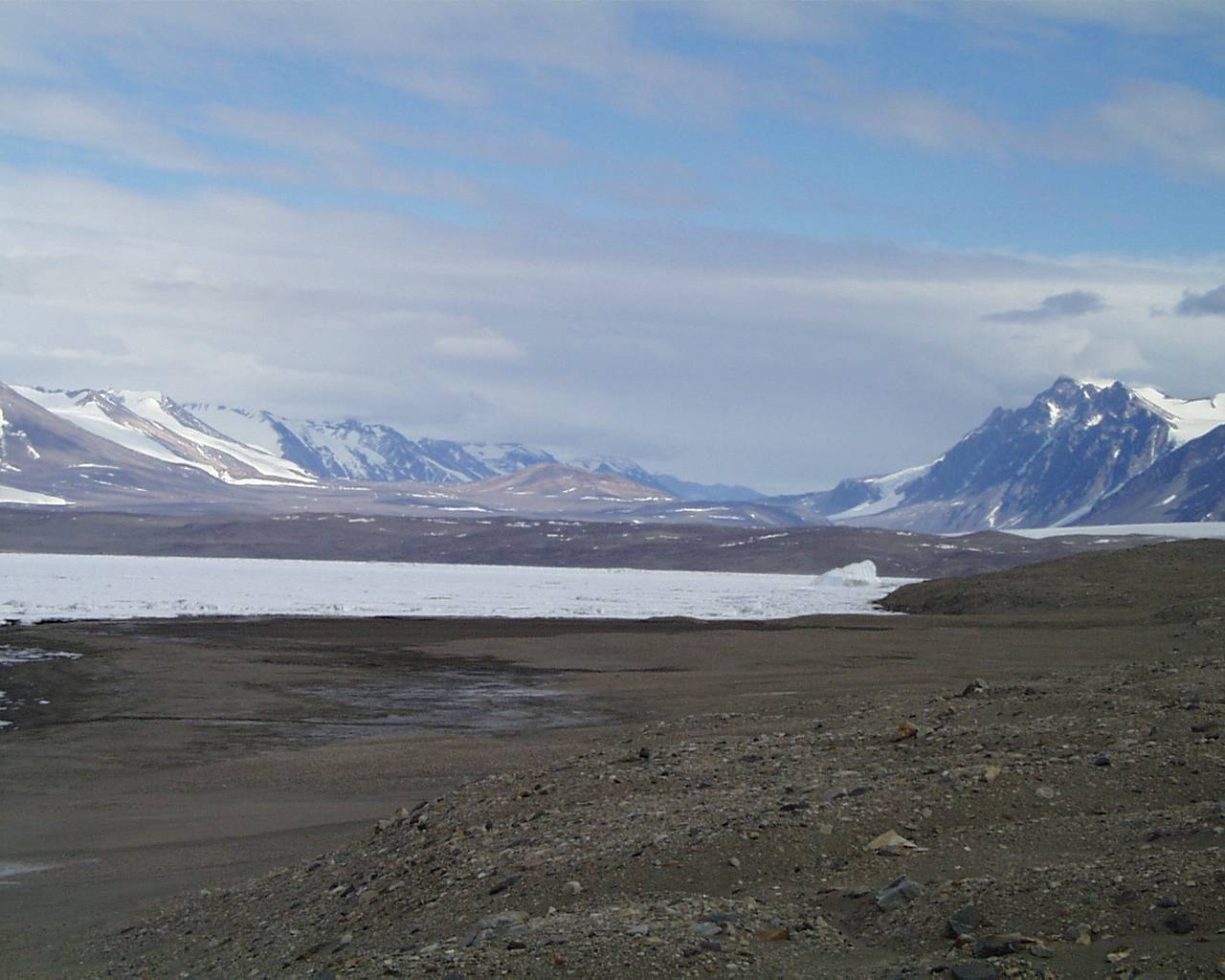 |
Above: Snow covered Cape Hickey, and the one small, frozen deposit. Cady Johnson piloting the A-Star, and the ship parked on a snow saddle at Cape Day. Granite bedrock along Cape Bernacchi, and the view into the famous Taylor Valley.
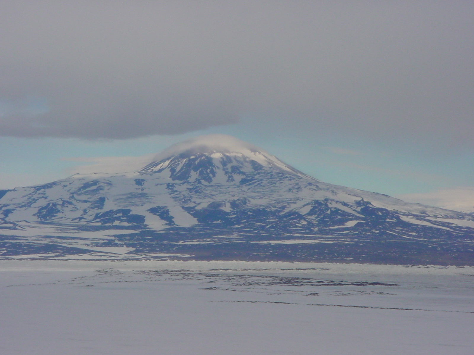
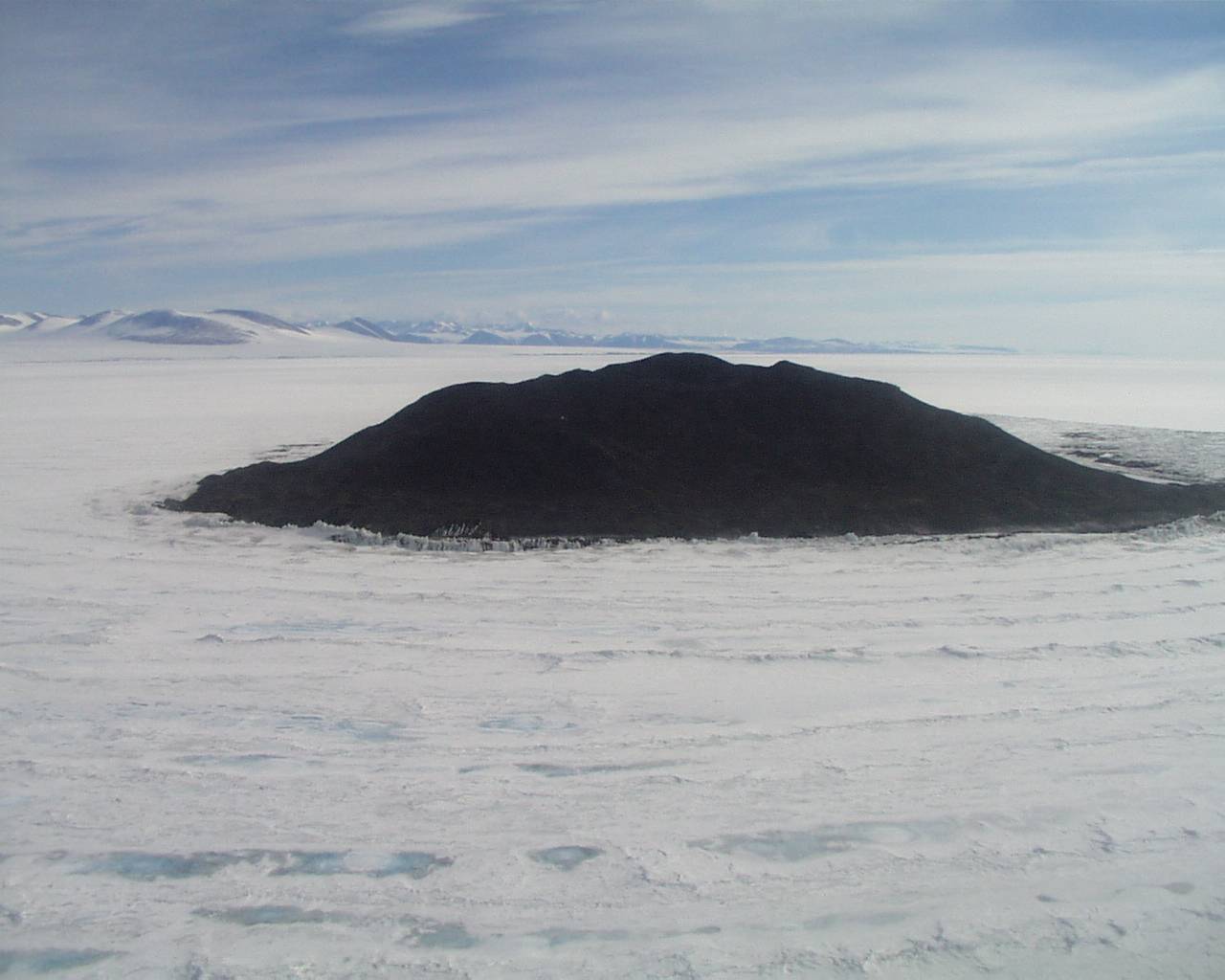
Early the next morning we were headed south in Scotty Pentecost’s A-star enroute to Black Island, one of the landmarks visible from McMurdo Station. Black Island can be easily distinguished from its neighbor White Island by the fact that it is entirely free of snow cover. The winds from the polar plateau routinely scour the island and deposit the spindrift to the leeward on White Island. It was another mellow day, however, with only very light winds, so we surveyed around the northernmost cape in comfortable conditions. Black Island is dramatic in its barren nature. The heavy wind scouring has produced a dense desert pavement on the surface, and the black volcanic rocks composing this surface are heavily wind abraded. Again the frigid desert environment of the continent became obvious. And as we suspected, Black Island is too far south for penguin breeding; no abandoned colonies were found, only sterile beach sands. Waiting for Scotty to pick us up, we climbed to the top of Mt. Melania, establishing a personal “farthest south” at approximately 78 degrees, 7 minutes south. We were rewarded with a spectacular view of Mt. Discovery, and a glimpse of the route up the Ross Ice Shelf that the early explorers took on their way to the Beardmore Glacier and onward to the South Pole. It was a humbling view, seeing the vast icefield that would have seen several depots of food and fuel necessary for these early attempts. After we were picked up, we made an aerial survey of the Daily Islands, a group of small volcanic lumps sticking up out of the ice shelf. Only one appeared worth a quick stop, so Scotty parked the A-star on a narrow beach. Again we found no fossil rookeries, only sterile beaches, but we saw one very large seal carcass that appeared to have been butchered, most likely by turn-of-the-century visitors to the region. On the flight back we surveyed Cape Chocolate, and Scotty flew us within spitting distance of the glacial snout for a close look. I have grown very impressed with the skills of the helo pilots flying down here.
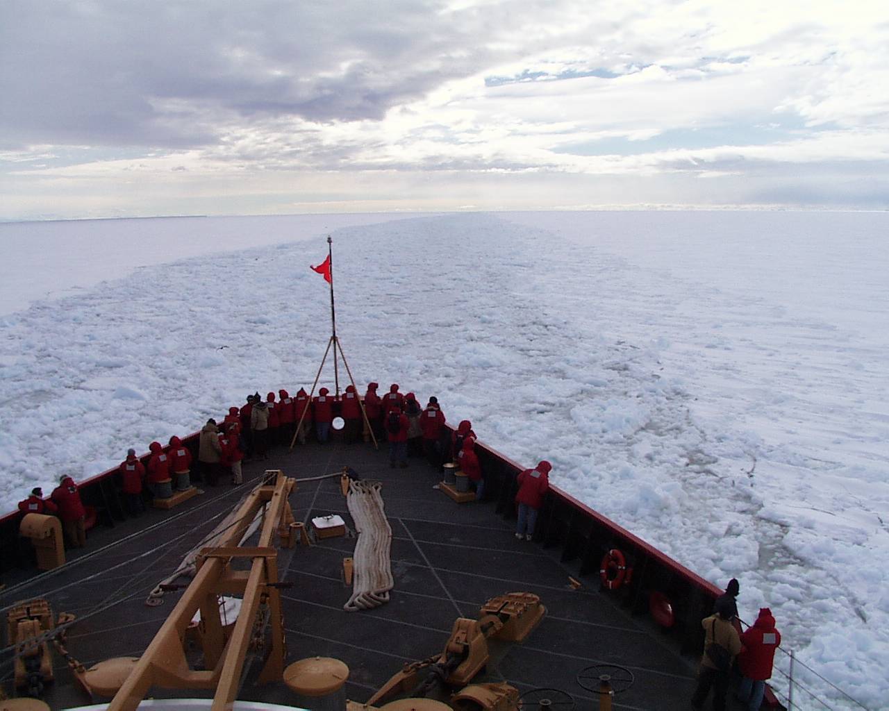
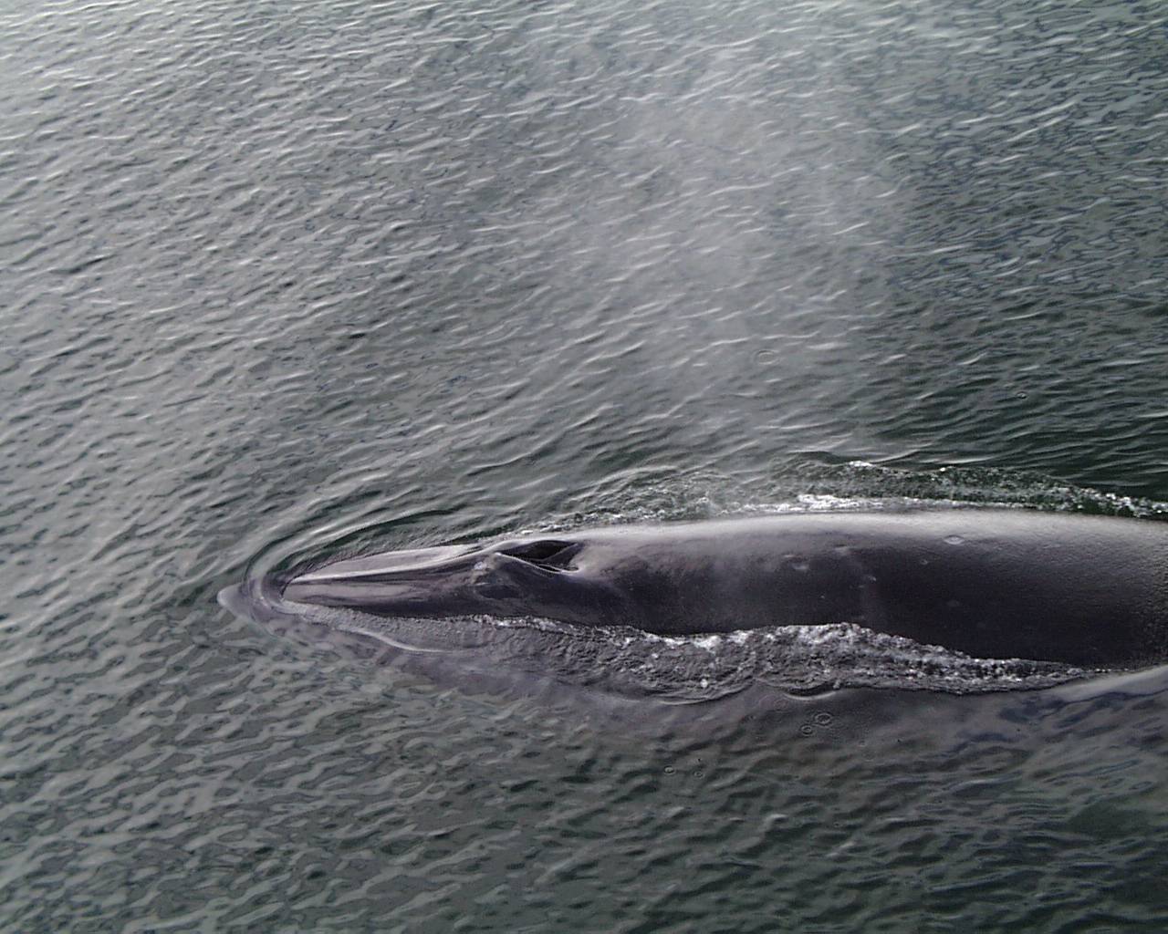
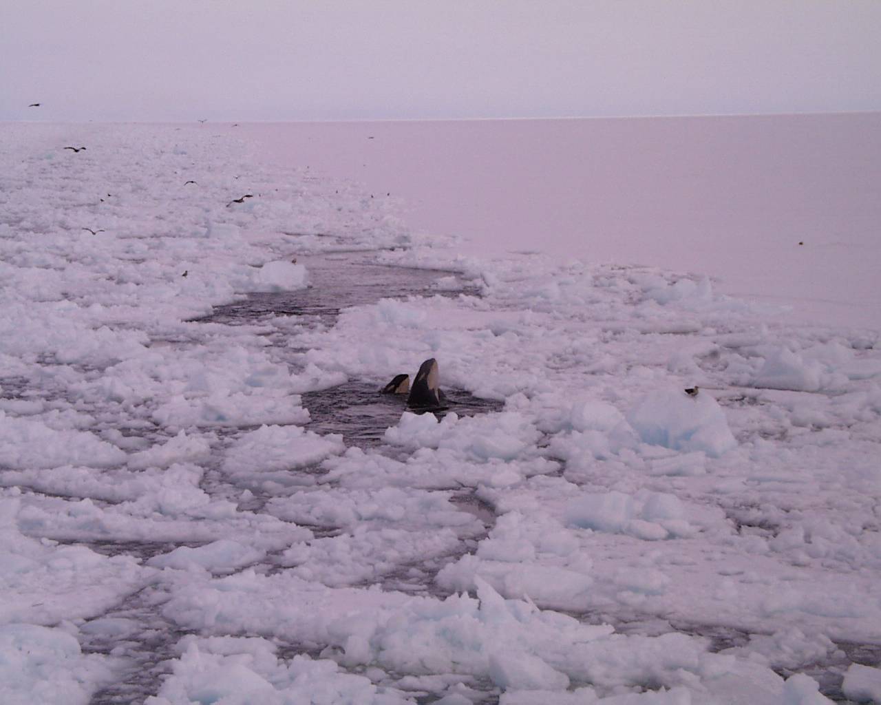
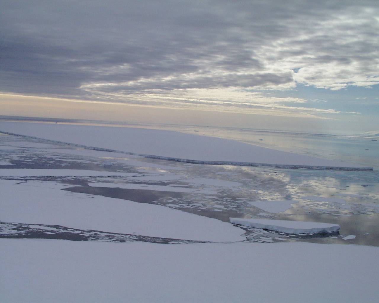
Our icebreaker journey to Cape Hallett did not work out, the schedule was simply too tight between the return of the Polar Sea and our departure from the continent. But we did get a consolation prize: the icebreaker was offering “morale cruises” to the residents of McMurdo out to the ice edge and back, and we tagged along on Sunday afternoon. The experience of riding in a Coast Guard icebreaker was amazing, and icebreaking through the “brash ice” in the channel the Polar Sea had carved into McMurdo Sound was thrilling. The ships' crew was hospitable, and we had the run of all of the boat except the living quarters. The bridge was particularly impressive- a massive enclosure with windows all around and crammed with instruments and consoles. A young and pretty Coast Guard sailor nonchalantly drove the ship while explaining the controls to curious visitors. But the real show began as we approached the ice edge. In the brash-filled channel whales were abundant. Minke whales drew alongside, and orcas “spy-hopped” through ice holes, checking out what was going on around them on the ice. For some sense of what it feels like to have such a close view of these magnificent beasts, click on the following short movies Mike shot with his digital camera: Minke1, Minke2, OrcaVideo. All too soon we were steaming back to McMurdo, arriving just in time for a prime rib dinner. Our morale was certainly lifted by our visit on the Polar Sea!
On Tuesday we completed our last field outing for the season. We flew with Cady up to Cape Roberts and Spike Cape, the only exposed sections of beach we had not visited within helicopter range of McMurdo Base. Cape Roberts is the site of a Kiwi remediation camp, and is another stark point jutting into the Ross Sea paved with densely packed granite boulders. We surveyed the beach terraces to no avail, but at the very highest point of the cape Steve located an area paved with diagnostic pebbles. A quick probe confirmed that this was indeed a site, and we excavated a hasty test pit as a single level. The lack of feathers and degraded state of the bone hinted at great age for the site. Cady flew us to Spike Cape, and transferred Brenda Hall’s group out to Dunlop Island while we surveyed for sites. Surprisingly for such a similar setting to other sites we have found, no colonies appear to have occupied Spike Cape or the long beachline to the south. An interesting geomorphologic problem was revealed to us there, however. Emerging undamaged beneath the retreating glacial front are a series of beach terraces, demonstrating that such features may survive repeated glacial advances and retreats intact. Cady flew the ship down to pick us up; we boarded and departed the mainland for the last time. On the flight back a low cloudbank muted the sunlight that usually produced harsh shadows along the ice edge this time of day and instead a beautiful purplish light pervaded the scene. We flew close by a calved portion of the iceshelf, designated B-15A, a massive iceberg that is being closely watched as a threat to the icebreaker channel carved by the Polar Sea. One day of winds in the wrong direction and this berg could seal the channel to ship traffic.
Our final days in Antarctica will be spent organizing and returning all our field equipment and in the lab. Our goal is to pick all the coarser sediments so the bulk of the sterile pea-sized gravels can be left here, and only fine-screened matrix transported to North Carolina for detailed microscopic analysis. Our picking is revealing some interesting data concerning the diet of Adélie penguins. Field researchers such as we met at Capes Crozier, Bird, and Royds routinely perform stomach pumping of study birds to check on what they are eating. And when recently killed chick carcasses are recovered before the skuas eat the internal organs stomach contents are also recovered. All field data suggests that the birds are exclusively feeding on krill and fish. Evidence from the Antarctic Peninsula also supports this conclusion, but Steve’s excavations there found abundant evidence of squid in the diet, based upon the presence of large quantities of squid beaks (the only part of the animal that will preserve) in the samples. Our samples also contain squid beaks, indicating that penguins here are utilizing squid as a food source as well. So why are squid missing from the diet samples taken by the field biologists? Steve’s hypothesis is that during chick rearing season, the only time of year that is intensively studied by biologists, the birds rely on food sources that pack the most punch, or provide the most nutrition per gram, as chick survival is so dependant upon chicks fattening up and growing rapidly into adult forms. Krill would provide the most concentrated and energy-rich food. But later in the season, once the biologists have ended their research season, the adult penguins may add alternative foods to their diet, including squid species such as Psychroteuthis glacialis that Steve has identified from his peninsular studies (Emslie et al., 1998). This hypothesis awaits testing by late-season diet sampling, a task made more difficult by the fact that populations of penguins disperse onto the sea ice at that time of year.
Our field season has been a tremendous success, with the discovery and excavation of ten widely separated fossil colonies, and the sampling of three different modern colonies for comparison. Steve had hoped for as many as five fossil sites, so he has succeeded in doubling his goal. And many of the test pits proved rich with preserved remains, so the likelihood is high that much dietary data will be obtained. Our season also proved safe and comfortable, with no big storms or accidents affecting our stalwart trio. On Monday we will board a transport jet, a C-141 on the blue-ice runway Pegasus, and wing our way northward for a five-hour flight to Christchurch. I will be spending almost a month touring the South Island, and hope to climb some peaks and visit many parks in this unique and dramatic environment. It will also be good to don shorts and flip-flops again and feel breezes a little less biting. But I hope that I will take away some of the wild feeling of this incredibly harsh and beautiful landscape, and maybe return someday for further adventures. Cheers, Larry Coats
References Cited:
Baroni, C. and Orombelli, G., 1994. Abandoned penguin rookeries as Holocene paleoclimate indicators in Antarctica. Geology 22, pp. 23-26.
Emslie, S. D., Fraser, W, Smith, R. C, and Walker, W. (1998). Abandoned penguin colonies and environmental change in the Palmer Station area, Anvers Island, Antarctic Peninsula. Antarctic Science 10 (3), pp. 257-268.
.jpg)